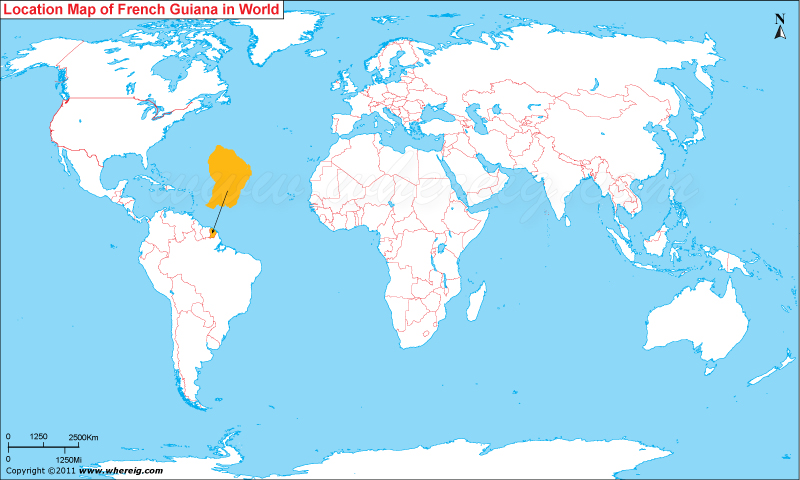
The given French Guiana location map shows that French Guiana is located in the northern part of South America continent.
French Guiana is geostrategic overseas territory of France. Cayenne is the largest as well as capital city of the territory. French Guiana map shows that it shares its international boundaries with Surinam in the west and Brazil in the east and south. However, French territory has coastline in the northern side; likewise, Atlantic Ocean limits its northward extensions.
By virtue of nearby Equator location, country has wide range of biodiversity and ecosystems. For instance tropical rainforests, coastal mangroves, savannahs, and many types of wetlands are the significant ecosystem.
The economy of the territory is largely depends upon France for subsidies, trade, and goods. However, some of the local means of revenue are fishing (accounting for three-quarters of foreign exports), gold mining and timber. The world's one of the most important Space centers i.e. Guiana Space Centre at Kourou located in the region. The presence of this space center is great source of employment on the territory because it has employed 1,700 people and accounts for 25% of the GDP.
| Country | French Guiana |
| Continent | South America |
| Where is Located | French Guiana is a country located in the Northern South America |
| Coordinates | 4° 0' 0 N, 53° 0' 0 W |
| Capital | Cayenne |
| Largest City | |
| Neighboring Countries | Brazil, Suriname |
| Administrative divisions | None |
| Area | 32,253 Sq mi (83,534 Sq Km) |
| Population | 236,250 (2011 Est.) |
| Official Language | French |
| Currency | Euro |
| ISO Alpha-2 Code | GF |
| ISO Alpha-3 Code | GUF |
| ISO Numeric Code | 254 |
| GDP | €3.81 billion |
| Calling code | |
| Time Zone | GFT (UTC-03) |


