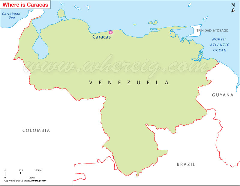
Location Map of Caracas on Venezuela map
Caracas is the largest and capital city of Venezuela. Caracas is situated entirely within a valley of the Venezuelan central range. It is separated from the Caribbean coast by an approximately 15 km expanse of El Avila National Park.
Furthermore, Caracas is the economic center of the country; businesses located in the city are service companies, banks, and malls. However, largely the economic activity is concentrated in services, excepting some of the industries those have been established in the centre of metropolitan area. For example chemicals, textiles, food, iron, leather, and wood products are the significant one. Besides, there are also rubber and cement factories in the city.
Country: Venezuela
Status: Venezuelan Capital District
Location: north of the country
Foundation year: 25 July 1567
Founded by: Diego de Losada
Area: 1,930 km2
Time zone: UTC-04:30
Postal code: 1010-A
Area code: 212
Climate: Tropical savanna
Furthermore, Caracas is the economic center of the country; businesses located in the city are service companies, banks, and malls. However, largely the economic activity is concentrated in services, excepting some of the industries those have been established in the centre of metropolitan area. For example chemicals, textiles, food, iron, leather, and wood products are the significant one. Besides, there are also rubber and cement factories in the city.
Interesting Facts about Canberra
Country: Venezuela
Status: Venezuelan Capital District
Location: north of the country
Foundation year: 25 July 1567
Founded by: Diego de Losada
Area: 1,930 km2
Time zone: UTC-04:30
Postal code: 1010-A
Area code: 212
Climate: Tropical savanna


