Where is / Where is Australia / Where is Nambour

Where is Nambour, Australia?


Written and Fact-checked by | Updated On: November 08, 2025, 21:10 ET


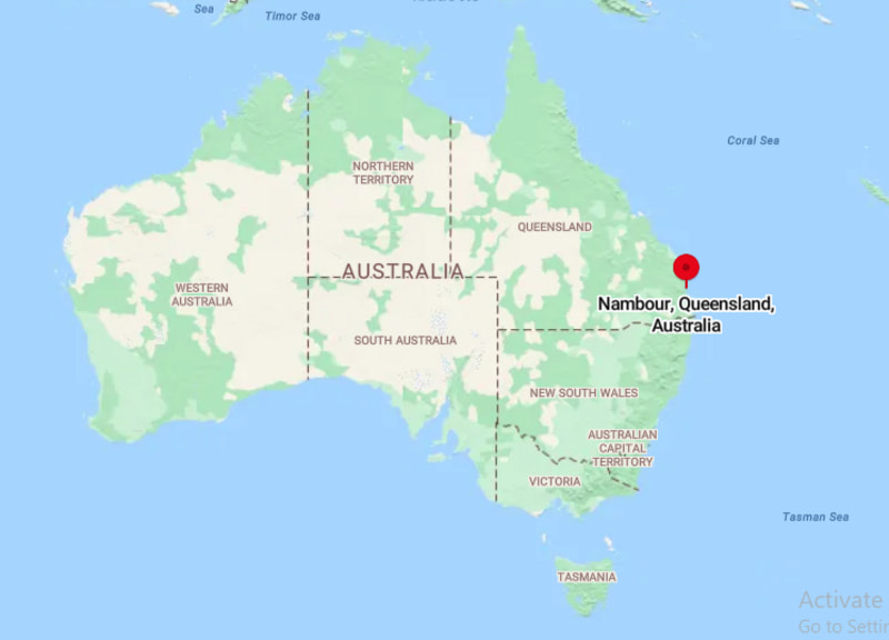
Location Map of Nambour, Australia

Where is Nambour, Australia
About Map: The map showing location of Nambour, Australia.


Nambour City Facts, Australia

City NameNambour
Nickname(s)"The Sunshine Hinterland Town"
Region / TypeTown / Suburb
Local Government AreaSunshine Coast Region
StateQueensland (QLD)
CountryAustralia
LocationLocated in the Sunshine Coast hinterland, northeast Queensland, approx. 100 km north of Brisbane.
Coordinates26.6264� S, 152.9594� E
Latitude-26.6264
Longitude152.9594
Elevation~98 m (322 ft)
Established1870s (settled), 1890 (named Nambour)
IncorporatedPart of Sunshine Coast governance (not an independent municipality)
Population (2021 Census)15,550
Population Density (per sq mi)~1,070 (approx.)
Area (Sq mi)~14.5 sq mi (37.6 km�)
Metro AreaGreater Sunshine Coast
Official LanguageEnglish
DemonymNambour Local / Sunshine Coaster
CurrencyAustralian Dollar (AUD)
Time ZoneAEST (UTC +10:00)
Postal Code4560
Area Code+61 7
Government TypeLocal Government � Sunshine Coast Region
Major IndustriesAgriculture, Healthcare, Tourism, Education, Retail
Major HighwaysBruce Highway (A1), Nambour�Mapleton Road
Rail ServiceNambour Railway Station (Queensland Rail North Coast Line)
Nearest AirportSunshine Coast Airport (Maroochydore)
Airport Distance from Downtown~17 km (10.5 miles)
ClimateHumid Subtropical (Warm summers, mild winters)
Average Annual Temperature~70�F (21�C)
Famous ForHistoric sugar cane industry, Big Pineapple, Sunshine Coast Hinterland access
Places to VisitThe Big Pineapple, Kondalilla National Park, Nambour Heritage Tramway, Mapleton Falls, Sunshine Coast attractions
Sports TeamsNambour Crushers Rugby League, Nambour Rugby Union Club
Sister CitiesNone officially listed
Nearest Major CitiesSunshine Coast (14 km), Brisbane (100 km)
Motto"Heart of the Hinterland"
Websitehttps://www.sunshinecoast.qld.gov.au