Where is / Where is Australia / Where is Port Augusta

Where is Port Augusta, Australia?


Written and Fact-checked by | Updated On: November 08, 2025, 21:10 ET


Location Map of Port Augusta, Australia
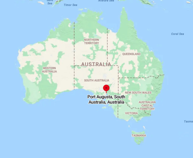
Where is Port Augusta, Australia
About Map: The map showing location of Port Augusta, Australia.


Port Augusta City Facts, Australia

City NamePort Augusta
Nickname(s)"Crossroads of Australia", "The Gateway to the Outback"
Region / TypeRegional City
Local Government AreaCity of Port Augusta
StateSouth Australia (SA)
CountryAustralia
LocationLocated at the northern end of Spencer Gulf and at the junction of major inland routes connecting Adelaide, Perth, Darwin, and the Outback.
Coordinates32.4912� S, 137.7650� E
Latitude-32.4912
Longitude137.7650
Elevation16 ft (5 m)
Established1852
Incorporated1875
City Status Granted1963
Founded ByAlexander Elder
Population (2021 Census)~13,900
Population Density (per sq mi)~540
Area (Sq mi)~25.75
Metro AreaUpper Spencer Gulf Region
Official LanguageEnglish
DemonymPort Augustan
CurrencyAustralian Dollar (AUD)
Time ZoneACST (UTC+9:30) / ACDT (UTC+10:30 DST)
Postal Code5700
Area Code+61 8
Government TypeLocal Government (City Council)
Main IndustriesTransport, Energy, Mining Services, Tourism, Logistics
Major HighwaysStuart Highway, Eyre Highway, Augusta Highway
Rail ServiceThe Ghan (Passenger), Freight Network
Nearest AirportPort Augusta Airport (PUG)
Airport Distance from Downtown~3 miles (5 km)
ClimateHot Desert Climate
Average Annual Temperature69.8�F (21�C)
Famous ForTransport Hub, Spencer Gulf, Outback Gateway, Railway Heritage
Places to VisitAustralian Arid Lands Botanic Garden, Wadlata Outback Centre, Matthew Flinders Lookout, Water Tower Lookout, Spencer Gulf Foreshore
Sports TeamsPort Augusta Hawks (AFL), South Augusta Bulldogs
Sister CitiesNone officially
Nearest Major CitiesWhyalla (45 mi), Port Pirie (55 mi), Adelaide (190 mi)
Motto"Where the Outback Meets the Sea"
Websitehttps://www.portaugusta.sa.gov.au