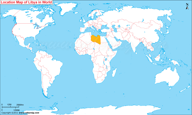
Where is Libya located on the world map? The given Libya location map shows that Libya is located in the northern part of Africa continent.
Libya map also shows that it shares its international boundaries with Egypt in the east, Sudan in the south-east, Chad and Niger in the south, and Algeria and Tunisia in the west. However, in the north, Mediterranean Sea limits its northward extensions.
Geographically, Libya is the fourth largest country in the Africa continent. In comparison of other African countries, Libya has the highest HDI and hence, it has fourth highest GDP (PPP) per capita in Africa. However, the reason behind this is of course due to the large reserves of petroleum that makes Libya – the tenth largest oil-producing country in the world.
Moreover, the government type of Libya is under transitional phase because of the civilians are revolted for the transformation into the republic from the authoritarian type. However, very soon Libya will be also republic country.
| Country | Libya |
| Continent | Africa |
| Where is Located | Libya is a country located in the Northern Africa |
| Coordinates | 32.866667, 13.183333 |
| Capital | Tripoli |
| Largest City | Tripoli |
| Neighboring Countries | Algeria, Chad, Egypt, Niger, Sudan, Tunisia |
| Administrative divisions | 22 districts |
| Area | 1,759,541 sq km ( 679,359 sq miles) |
| Population | 5670688 (2006 census) |
| Official Language | Arabic |
| Currency | Libyan dinar (LYD) |
| ISO Alpha-2 Code | LY |
| ISO Alpha-3 Code | LBY |
| ISO Numeric Code | 434 |
| GDP | $95.941 billion 2012 estimate |
| Calling code | 218 |
| Time Zone | CET (UTC+1) |
| Internet TLD | .ly |
- Where is Algeria
- Where is Angola
- Where is Benin
- Where is Botswana
- Where is Burkina Faso
- Where is Burundi
- Where is Cameroon
- Where is Canary Islands
- Where is Cape Verde
- Central African Republic
- Where is Ceuta
- Where is Chad
- Where is Cote d'Ivoire
- Where is Congo
- Where is Djibouti
- Where is Egypt
- Equatorial Guinea
- Where is Eritrea
- Where is Ethiopia
- Where is Gabon
- Where is Gambia
- Where is Ghana
- Where is Guinea
- Guinea Bissau
- Where is Kenya
- Where is Lesotho
- Where is Liberia
- Where is Libya
- Where is Madagascar
- Where is Madeira
- Where is Malawi
- Where is Mali
- Where is Mauritania
- Where is Mauritius
- Where is Mayotte
- Where is Morocco
- Where is Mozambique
- Where is Namibia
- Where is Niger
- Where is Nigeria
- Where is Congo
- Where is Reunion
- Where is Rwanda
- Where is Saint Helena
- Where is Sao Tome
- Where is Senegal
- Where is Seychelles
- Where is Sierra Leone
- Where is South Africa
- Where is Sudan
- Where is Swaziland
- Where is Tanzania
- Where is Togo
- Where is Tunisia
- Where is Uganda
- Where is Western Sahara
- Where is Zambia
- Where is Zimbabwe


