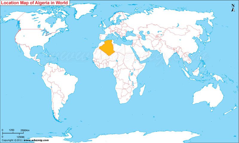
Map showing location of Algeria in the World Map.
Algeria officially the People's Democratic Republic of Algeria is a country in North Africa.
In terms of land area, it is the largest country on the Mediterranean Sea, the second largest on the African continent after Sudan, and the eleventh-largest country in the world .Algeria is bordered in the northeast by Tunisia, in the east by Libya, in the west by Morocco. The capital of Algeria is Algiers. The name of the country is derived from the city of Algiers.5 Major Cities of Algeria are Algiers, Oran, Bijaya, Constantine, Setif.Seven Algerian sites in the World Heritage List: Al Qal'a of Beni Hammad, Djemila, M Zab Valley, Tassili n Ajjer, Timgad, Tipasa, and the Kasbah of Algiers.
Some more sites are as follow:
Belzma National Park
Hammam Guergour
Babors mountains
Mostaganem
The Tassili du Hoggar
Hippone (so called Annaba)
Some more sites are as follow:
| Country | Algeria |
| Continent | Africa |
| Where is Located | Algeria is a country located in the Northern Africa |
| Coordinates | 36°42'N3°13'E |
| Capital | Algiers |
| Largest City | Algiers |
| Neighboring Countries | None |
| Administrative divisions | 48 provinces |
| Area | 2,381,741 sq km or 919,595 sq mi |
| Population | 38481705 |
| Official Language | Arabic (official), Berber,Turkish, French, Korandje |
| Major Religion | Islam, Christianity, Judaism |
| Currency | Algerian Dinar (DZD) |
| ISO Alpha-2 Code | DZ |
| ISO Alpha-3 Code | DZA |
| ISO & UN M49 Numeric Code | 12 |
| GDP | $325.0 billion (2012 est.) |
| Calling code | 213 |
| Time Zone | CET (UTC+01) |
| Internet TLD | .dz |
- Where is Algeria
- Where is Angola
- Where is Benin
- Where is Botswana
- Where is Burkina Faso
- Where is Burundi
- Where is Cameroon
- Where is Canary Islands
- Where is Cape Verde
- Central African Republic
- Where is Ceuta
- Where is Chad
- Where is Cote d'Ivoire
- Where is Congo
- Where is Djibouti
- Where is Egypt
- Equatorial Guinea
- Where is Eritrea
- Where is Ethiopia
- Where is Gabon
- Where is Gambia
- Where is Ghana
- Where is Guinea
- Guinea Bissau
- Where is Kenya
- Where is Lesotho
- Where is Liberia
- Where is Libya
- Where is Madagascar
- Where is Madeira
- Where is Malawi
- Where is Mali
- Where is Mauritania
- Where is Mauritius
- Where is Mayotte
- Where is Morocco
- Where is Mozambique
- Where is Namibia
- Where is Niger
- Where is Nigeria
- Where is Congo
- Where is Reunion
- Where is Rwanda
- Where is Saint Helena
- Where is Sao Tome
- Where is Senegal
- Where is Seychelles
- Where is Sierra Leone
- Where is South Africa
- Where is Sudan
- Where is Swaziland
- Where is Tanzania
- Where is Togo
- Where is Tunisia
- Where is Uganda
- Where is Western Sahara
- Where is Zambia
- Where is Zimbabwe


