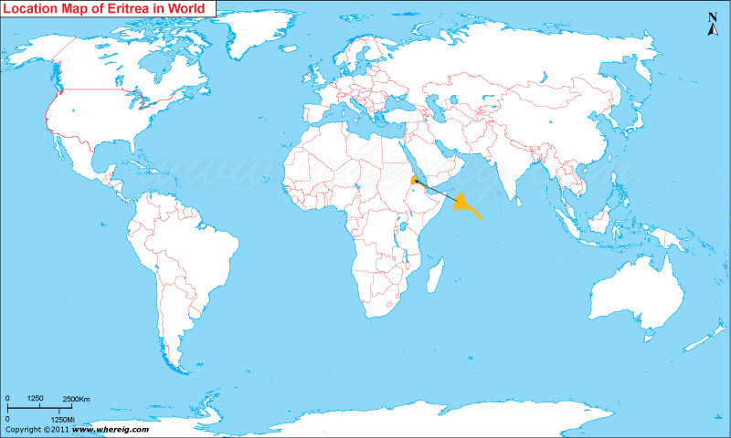
Where is Eritrea Located?
The given Eritrea location map shows that Eritrea is located in the eastern part of Africa continent.
Eritrea has several islands in the Red Sea including the Dahlak Archipelago and many of the Hanish Islands. The capital city of Eritrea is Asmara. The small country Eritrea is governed by the People's Front for Democracy and Justice (PFDJ). There are many languages spoken in Eritrea but significant of them are Tigrinya and Arabic.
Moreover, the economy of the country is largely depends upon the agriculture. There is 80% of the population involved in agriculture and herding.
| Country | Eritrea |
| Continent | Africa |
| Where is Located | Eritrea is a country located in the Eastern Africa |
| Coordinates | 15.1177° N, 38.9125° E |
| Capital | Asmara |
| Largest City | Asmara |
| Neighboring Countries | Djibouti, Ethiopia, Sudan |
| Administrative divisions | 6 regions |
| Area | 117,600 sq km |
| Population | 6,233,682 (July 2013 est.) |
| Official Language | Tigrinya, Arabic, English |
| Currency | Eritrean nakfa |
| ISO Alpha-2 Code | ER |
| ISO Alpha-3 Code | ERI |
| ISO Numeric Code | 232 |
| GDP | $800 (2012 est.) |
| Calling code | 291 |
| Time Zone | UTC+03:00 |
| Internet TLD | .er |
- Where is Algeria
- Where is Angola
- Where is Benin
- Where is Botswana
- Where is Burkina Faso
- Where is Burundi
- Where is Cameroon
- Where is Canary Islands
- Where is Cape Verde
- Central African Republic
- Where is Ceuta
- Where is Chad
- Where is Cote d'Ivoire
- Where is Congo
- Where is Djibouti
- Where is Egypt
- Equatorial Guinea
- Where is Eritrea
- Where is Ethiopia
- Where is Gabon
- Where is Gambia
- Where is Ghana
- Where is Guinea
- Guinea Bissau
- Where is Kenya
- Where is Lesotho
- Where is Liberia
- Where is Libya
- Where is Madagascar
- Where is Madeira
- Where is Malawi
- Where is Mali
- Where is Mauritania
- Where is Mauritius
- Where is Mayotte
- Where is Morocco
- Where is Mozambique
- Where is Namibia
- Where is Niger
- Where is Nigeria
- Where is Congo
- Where is Reunion
- Where is Rwanda
- Where is Saint Helena
- Where is Sao Tome
- Where is Senegal
- Where is Seychelles
- Where is Sierra Leone
- Where is South Africa
- Where is Sudan
- Where is Swaziland
- Where is Tanzania
- Where is Togo
- Where is Tunisia
- Where is Uganda
- Where is Western Sahara
- Where is Zambia
- Where is Zimbabwe


