
Croatia officially the Republic of Croatia, Croatia is a Country situated between central and eastern Europe bordering the Adriatic Sea between Slovenia and Bosnia and Herzegovina. It lies between latitudes 45.1000° North and longitudes 15.2000° East.
Location Map of Croatia
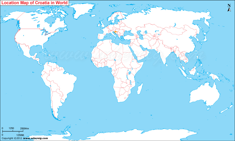
Where is Croatia Located?
The given location map of Croatia shows that Croatia is located in the central-south part of Europe continent. Croatia map also shows that Croatia shares its international boundaries with Slovenia in the north, Italy in the west, Hungary in the northeast, Bosnia-Herzegovina in the southeast, Serbia in the east, and Montenegro in the southeast. It also has coastline opening into the Adriatic Sea.
Croatia has had long history of its governance system under which it was ruled hundreds of years by several rulers; however, in the year 1991, Croatia became independence. Likewise, Croatia adopted a democratic parliamentary republic characterized with multi-party system. Besides, Croatia is member of the United Nations, the Council of Europe, NATO, WTO, and CEFTA.
Moreover, country has several beautiful landscapes and other tourist places. Country has some of the beautiful lakes, coastal areas, and picturesque mountain ranges. Hence, in recent times, tourism in Croatia has quite developed. Thousands of tourists from neighbor countries as well as from other part of the world are coming here for their holidays every year.
Counties of Croatia
| County | Capital | Population | Area | Latitude and Longitude |
|---|---|---|---|---|
| Zagreb County | Zagreb | 300,000+ | 3,060 sq km (1,181 sq mi) | 45.8150° N, 15.9819° E |
| Split-Dalmatia County | Split | 425,000+ | 4,540 sq km (1,753 sq mi) | 43.5081° N, 16.4402° E |
| Primorje-Gorski Kotar County | Rijeka | 265,000+ | 3,588 sq km (1,385 sq mi) | 45.3271° N, 14.4422° E |
| Osijek-Baranja County | Osijek | 260,000+ | 4,149 sq km (1,602 sq mi) | 45.5540° N, 18.6955° E |
| Istria County | Pazin | 195,000+ | 2,820 sq km (1,089 sq mi) | 45.2396° N, 13.9368° E |
| Zadar County | Zadar | 160,000+ | 3,646 sq km (1,408 sq mi) | 44.1194° N, 15.2314° E |
| Dubrovnik-Neretva County | Dubrovnik | 115,000+ | 1,781 sq km (688 sq mi) | 42.6507° N, 18.0944° E |
| Šibenik-Knin County | Šibenik | 100,000+ | 2,984 sq km (1,152 sq mi) | 43.7350° N, 15.8952° E |
| Vukovar-Srijem County | Vukovar | 145,000+ | 2,454 sq km (948 sq mi) | 45.3516° N, 19.0016° E |
| Sisak-Moslavina County | Sisak | 140,000+ | 4,468 sq km (1,725 sq mi) | 45.4872° N, 16.3750° E |
10 Largest Cities in Croatia
| City | County | Population | Latitude and Longitude |
|---|---|---|---|
| Zagreb | City of Zagreb | 770,000+ | 45.8150° N, 15.9819° E |
| Split | Split-Dalmatia County | 160,000+ | 43.5081° N, 16.4402° E |
| Rijeka | Primorje-Gorski Kotar County | 110,000+ | 45.3271° N, 14.4422° E |
| Osijek | Osijek-Baranja County | 95,000+ | 45.5540° N, 18.6955° E |
| Zadar | Zadar County | 75,000+ | 44.1194° N, 15.2314° E |
| Pula | Istria County | 55,000+ | 44.8666° N, 13.8496° E |
| Slavonski Brod | Brod-Posavina County | 50,000+ | 45.1603° N, 18.0156° E |
| Karlovac | Karlovac County | 49,000+ | 45.4929° N, 15.5553° E |
| Varaždin | Varaždin County | 45,000+ | 46.3057° N, 16.3366° E |
| Šibenik | Šibenik-Knin County | 42,000+ | 43.7350° N, 15.8952° E |
Top Tourist Attractions and Famous Places to Visit in Croatia
- Dubrovnik Old Town - Dubrovnik
- Plitvice Lakes National Park - Central Croatia
- Diocletian’s Palace - Split
- Krka National Park - Šibenik-Knin County
- Hvar Island - Split-Dalmatia County
- Pula Arena - Pula
- Zlatni Rat Beach - Brač Island
- Rovinj Old Town - Istria
- Sea Organ - Zadar
- Kornati National Park - Adriatic Sea
- Paklenica National Park - Zadar County
- Lokrum Island - Dubrovnik
- Trogir Historic Town - Split-Dalmatia County
- Mljet National Park - Dubrovnik-Neretva County
- St. James Cathedral - Šibenik
- Museum of Broken Relationships - Zagreb
Croatia Facts
| Continent | Europe |
| Country | Croatia |
| Capital | Zagreb |
| Largest City | Zagreb |
| Coordinates | 45.1000° N, 15.2000° E |
| Administrative Divisions | 20 Counties and 1 Capital City |
| Official Languages | Croatian |
| Demonym | Croatian |
| Government | Unitary Parliamentary Republic |
| Independence | 1991 |
| Total Area | 56,594 sq km (21,851 sq mi) |
| Population | 3.8 million+ (2024 est.) |
| Population Density | 67 people per sq km |
| Currency | Euro (€) |
| GDP Nominal | Approx. USD 95 billion |
| Economy | Advanced High-Income Economy |
| Postal Code Format | ##### |
| Country Calling Code | +385 |
| Time Zone | CET (UTC+1) |
| Internet TLD | .hr |
| ISO Country Code | HR |
| Driving Side | Right |
| Major Cities | Zagreb, Split, Rijeka, Osijek, Zadar |
| Major Airports | Zagreb Airport, Split Airport, Dubrovnik Airport |
| Highest Point | Dinara Peak (1,831 m) |
| Longest River | Sava River |
| Climate | Mediterranean and Continental Climate |
| Average Summer Temperature | 22°C to 30°C |
| Average Winter Temperature | -2°C to 10°C |
| Famous For | Adriatic Coast, Islands, Historic Cities, National Parks |
| National Animal | Pine Marten |
| National Sport | Football |
| National Dish | Peka |
| Official Website | gov.hr |
Major Rivers in Croatia
- Sava River
- Drava River
- Danube River
- Kupa River
- Neretva River
- Cetina River
- Korana River
- Mura River
Croatia Climate Facts
| Climate Type | Mediterranean along the coast and Continental inland |
| Summer Temperature | 22°C to 30°C |
| Winter Temperature | -2°C to 10°C |
| Average Rainfall | 600 mm to 3,500 mm annually depending on region |
Neighboring Countries of Croatia
- Slovenia - Northwest
- Hungary - Northeast
- Serbia - East
- Bosnia and Herzegovina - Southeast
- Montenegro - Southeast
References
- Official Government Website
- Croatian Bureau of Statistics
- World Bank
- CIA World Factbook
- United Nations Population Division
- Where is Albania
- Where is Andorra
- Where is Austria
- Where is Belarus
- Where is Belgium
- Bosnia and Herzegovina
- Where is Bulgaria
- Where is Croatia
- Where is Cyprus
- Where is Czech Republic
- Where is Denmark
- Where is England
- Where is Estonia
- Where is Finland
- Where is France
- Where is Germany
- Where is Greece
- Where is Hungary
- Where is Iceland
- Where is Ireland
- Where is Italy
- Where is Latvia
- Where is Liechtenstein
- Where is Lithuania
- Where is Luxemburg
- Where is Malta
- Where is Moldova
- Where is Monaco
- Where is Montenegro
- Where is Netherlands
- Where is Northern Ireland
- Where is Norway
- Where is Poland
- Republic Of Macedonia
- Where is Romania
- Where is Russia
- Where is San Marino
- Where is Scotland
- Where is Serbia
- Where is Slovakia
- Where is Slovenia
- Where is Spain
- Where is Sweden
- Where is Switzerland
- Where is Turkey
- Where is Ukraine
- Where is UK
- Where is Wales
- Where is Amsterdam
- Where is Athens
- Where is Belfast
- Where is Berlin
- Where is Brussels
- Where is Bucharest
- Where is Budapest
- Where is Copenhagen
- Where is Edinburgh
- Where is Helsinki
- Where is Kiev
- Where is Lisbon
- Where is London
- Where is Madrid
- Where is Moscow
- Where is Oslo
- Where is Paris
- Where is Riga
- Where is Rome
- Where is Sofia
- Where is Stockholm
- Where is Vienna
- Where is Warsaw