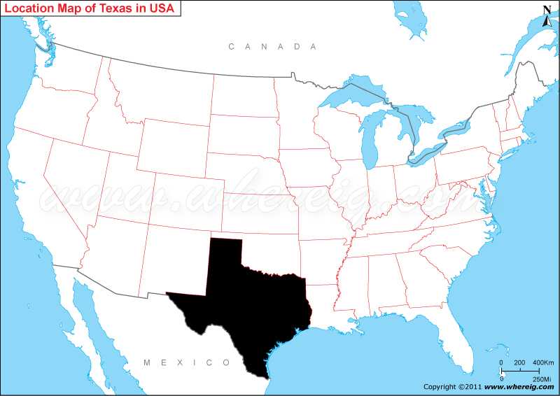
Where is Texas located on the US map?
Texas map also illustrates that it shares its border with Oklahoma in the north, New Mexico in the west, Louisiana in the east and Arkansas in the north-east. Besides, it also shares international border with Mexico in the south and coastline along the Mexico Gulf.
Surprisingly, the second largest state of the United States Texas has the maximum number of counties i.e. 254, more than any other state of the United States. Due to vast area, the climate type of state also varies greatly i.e. from cold to semi-arid and arid.
The capital city of Texas is Austin but the other larger and significant cities are Houston, San Antonio, and Dallas. However, Texas has four metropolitan areas - Dallas-Fort Worth-Arlington, Houston-Sugar Land-Baytown, San Antonio-New Braunfels, and Austin-Round Rock-San Marcos.
<
Where is Texas Located?
Texas map also illustrates that it shares its border with Oklahoma in the north, New Mexico in the west, Louisiana in the east and Arkansas in the north-east. Besides, it also shares international border with Mexico in the south and coastline along the Mexico Gulf.
Surprisingly, the second largest state of the United States Texas has the maximum number of counties i.e. 254, more than any other state of the United States. Due to vast area, the climate type of state also varies greatly i.e. from cold to semi-arid and arid.
The capital city of Texas is Austin but the other larger and significant cities are Houston, San Antonio, and Dallas. However, Texas has four metropolitan areas - Dallas-Fort Worth-Arlington, Houston-Sugar Land-Baytown, San Antonio-New Braunfels, and Austin-Round Rock-San Marcos.
<
Most Viewed Links
Texas State - Quick Facts
| Country: | United States |
| Region Type: | State |
| Capital: | Austin |
| Abbreviation: | TX, Tex. US-TX |
| Largest City: | Houston |
| Area: | 268,58 sq mi (696,241 km2) |
| Population: | 26,448,193 (2013 est) |
| Joined The Union: | -19724 |
| Nickname: | The Lone Star State |
| Highest Point: | Guadalupe Peak |
| Lowest Point: | Gulf of Mexico |
| Timezone: | most of state Central: UTC −6/−5 ,Tip of West Texas: Mountain: UTC −7/−6 |
| Official Website: | www.texas.gov |
Location Map of USA with States
- Where is Alabama (AL)
- Where is Alaska
- Where is Arizona
- Where is Arkansas Location Mapp
- Where is California
- Where is Colorado
- Where is Connecticut
- Where is Delaware
- Where is Florida
- Where is Georgia
- Where is Hawaii
- Where is Idaho State Map
- Where is Illinois
- Where is Indiana
- Where is Iowa
- Where is Kansas
- Where is Kentucky
- Where is Louisiana
- Where is Maine
- Where is Maryland
- Where is Massachusetts
- Where is Michigan
- Where is Minnesota
- Where is Mississippi
- Where is Missouri
- Where is Montana
- Where is Nebraska
- Where is Nevada
- Where is New Hampshire
- Where is New Jersey
- Where is New Mexico
- Where is New York
- Where is North Carolina
- Where is North Dakota
- Where is Ohio
- Where is Oklahoma
- Where is Oregon
- Where is Pennsylvania
- Where is Rhode Island
- Where is South Carolina
- Where is South Dakota
- Where is Tennessee
- Where is Texas
- Where is Utah
- Where is Vermont
- Where is Virginia
- Where is Washington
- Where is West Virginia
- Where is Wisconsin
- Where is Wyoming


