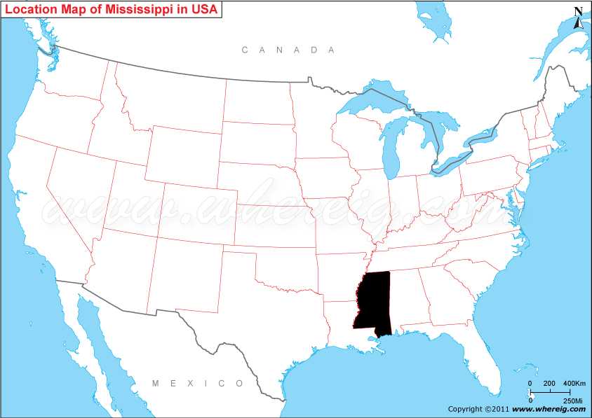
Map showing location of Mississippi on the US map.
Jackson is the capital and largest city of Mississippi. The state is lush with forest outside of the Mississippi Delta area. The catfish aquaculture farms of Mississippi produce the majority of farm-raised catfish consumed in the United States. The climate type of Mississippi is a humid subtropical.
The important cities of Mississippi are: Jackson, Gulfport, Hattiesburg Biloxi, and Southaven etc.
Where is Mississippi Located?
The given Mississippi location map shows that Mississippi is located in the southern part of the USA. Map of Mississippi also shows that it shares its administrative border with Alabama in the east, Tennessee in the north, Arkansas in the north-west, and Louisiana in the south-west. Besides, it has also small coastline along the Gulf of Mexico. The name Mississippi of the state is derived from the Mississippi River, which flows along its western boundary.Jackson is the capital and largest city of Mississippi. The state is lush with forest outside of the Mississippi Delta area. The catfish aquaculture farms of Mississippi produce the majority of farm-raised catfish consumed in the United States. The climate type of Mississippi is a humid subtropical.
The important cities of Mississippi are: Jackson, Gulfport, Hattiesburg Biloxi, and Southaven etc.
Mississippi State Facts
| Country: | United States |
| Region Type: | State |
| Capital: | Jackson |
| Abbreviation: | MS, Miss. US-MS |
| Largest City: | Jackson |
| Area: | 48,430 sq mi (125,443 km2) |
| Population: | 2,984,926 (2012 est) |
| Joined The Union: | December 10, 1817 (20th) |
| Nickname: | Magnolia State |
| Highest Point: | Woodall Mountain |
| Lowest Point: | Gulf of Mexico |
| Timezone: | Central: UTC −6/−5 |
| Official Website: | https://www.mississippi.gov/ |
Other Mississippi Maps & Info
Location Map of USA with States
- Where is Alabama (AL)
- Where is Alaska
- Where is Arizona
- Where is Arkansas Location Mapp
- Where is California
- Where is Colorado
- Where is Connecticut
- Where is Delaware
- Where is Florida
- Where is Georgia
- Where is Hawaii
- Where is Idaho State Map
- Where is Illinois
- Where is Indiana
- Where is Iowa
- Where is Kansas
- Where is Kentucky
- Where is Louisiana
- Where is Maine
- Where is Maryland
- Where is Massachusetts
- Where is Michigan
- Where is Minnesota
- Where is Mississippi
- Where is Missouri
- Where is Montana
- Where is Nebraska
- Where is Nevada
- Where is New Hampshire
- Where is New Jersey
- Where is New Mexico
- Where is New York
- Where is North Carolina
- Where is North Dakota
- Where is Ohio
- Where is Oklahoma
- Where is Oregon
- Where is Pennsylvania
- Where is Rhode Island
- Where is South Carolina
- Where is South Dakota
- Where is Tennessee
- Where is Texas
- Where is Utah
- Where is Vermont
- Where is Virginia
- Where is Washington
- Where is West Virginia
- Where is Wisconsin
- Where is Wyoming


