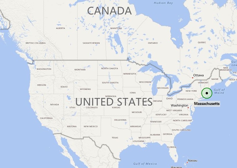
Massachusetts US is a state of the New England region; as shown in the given Massachusetts location map that Massachusetts is located in the north-eastern part of the United States.
On the given map of Massachusetts one can find - it is bordered by Connecticut and Rhode Island from the south, New York in the west, and New Hampshire and Vermont in the north. However, in the eastern side of Maine Atlantic Ocean lies.
The Massachusetts is the education capital of the world because of the Harvard University situated in the Cambridge city. Today, the state is a leader in higher education, health care, high technology, and financial services. State’s more than 6.6 million populations live in the Boston metropolitan city. Boston is the capital city of the state. By taking help of the given Massachusetts map US one can find it the eastern half of the state comprises of urban, suburban, and rural areas, whereas Western Massachusetts is largely rural.
Throughout the history, Massachusetts US has been popular and in news; this is the first place of English settlement and also one of the first places that became the centre of US freedom movement. Above all, its city Boston is more popularly known as “Cradle of Liberty” for the agitation that led to the American Revolution for the independence from Great Britain; one of the most significant incidents in the history i.e. “Boston Tea Party” had been happened here. And, in the modern era Massachusetts again in news because it is the first U.S. state that legally recognizes same-sex marriage.
Moreover, to get more information and rout guide you can take help of the Massachusetts Map US. Massachusetts state map carries detail information about the state including major cities, roadways, and railways.
Massachusetts State - Quick Facts
| Country: | United States |
| Region Type: | State |
| Capital: | Boston |
| Abbreviation: | MA, Mass. US-MA |
| Largest City: | Boston |
| Area: | 10,555 sq mi (27,336 km2) |
| Population: | 7,029,917 (2020 Census) |
| Joined The Union: | February 6, 1788 (6th) |
| Nickname: | The Bay State |
| Highest Point: | Mount Greylock |
| Lowest Point: | Atlantic Ocean |
| Timezone: | Eastern: UTC -5/-4 |
| Official Website: | www.mass.gov |
Location Map of USA with States
- Where is Alabama (AL)
- Where is Alaska
- Where is Arizona
- Where is Arkansas Location Mapp
- Where is California
- Where is Colorado
- Where is Connecticut
- Where is Delaware
- Where is Florida
- Where is Georgia
- Where is Hawaii
- Where is Idaho State Map
- Where is Illinois
- Where is Indiana
- Where is Iowa
- Where is Kansas
- Where is Kentucky
- Where is Louisiana
- Where is Maine
- Where is Maryland
- Where is Massachusetts
- Where is Michigan
- Where is Minnesota
- Where is Mississippi
- Where is Missouri
- Where is Montana
- Where is Nebraska
- Where is Nevada
- Where is New Hampshire
- Where is New Jersey
- Where is New Mexico
- Where is New York
- Where is North Carolina
- Where is North Dakota
- Where is Ohio
- Where is Oklahoma
- Where is Oregon
- Where is Pennsylvania
- Where is Rhode Island
- Where is South Carolina
- Where is South Dakota
- Where is Tennessee
- Where is Texas
- Where is Utah
- Where is Vermont
- Where is Virginia
- Where is Washington
- Where is West Virginia
- Where is Wisconsin
- Where is Wyoming


