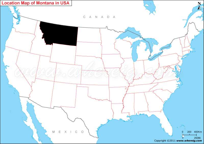
Map showing location of Montana located on the world map?
Geographically, Montana comprises various mountain ranges along with Rocky Mountain Range. Interestingly, the state name i.e. Montana is derived from Spanish word montaña meaning mountain. Besides, it has also some of the common nicknames, such as - "The Treasure State," "Big Sky Country, Land of the Shining Mountains, and The Last Best Place.
Surprisingly, the one of the sparsely populated Montana states receives millions of tourists every year. Some of the most visited tourist points are Glacier National Park, the Battle of Little Bighorn site, and three of the five entrances to Yellowstone National Park.
The climate type of Montana is semi-arid and continental climate.
Where is Montana State Located?
The given Montana location map shows that Montana is located in the north-western part of the US. Map of Montana also shows that it shares state borders with North Dakota in the east, South Dakota in the south-east, Wyoming in the south, and Idaho in the west. Montana map also illustrates that it also shares international border with Canada in the north.Geographically, Montana comprises various mountain ranges along with Rocky Mountain Range. Interestingly, the state name i.e. Montana is derived from Spanish word montaña meaning mountain. Besides, it has also some of the common nicknames, such as - "The Treasure State," "Big Sky Country, Land of the Shining Mountains, and The Last Best Place.
Surprisingly, the one of the sparsely populated Montana states receives millions of tourists every year. Some of the most visited tourist points are Glacier National Park, the Battle of Little Bighorn site, and three of the five entrances to Yellowstone National Park.
The climate type of Montana is semi-arid and continental climate.
Montana State - Quick Facts
| Country: | United States |
| Region Type: | State |
| Capital: | Helena |
| Abbreviation: | MT, Mont. US-MT |
| Largest City: | Billings |
| Area: | 147,040 sq mi (380,800 km2) |
| Population: | 1,084,225 (2020 Census) |
| Joined The Union: | November 8, 1889 (41st) |
| Nickname: | Big Sky Country, The Treasure State, Land of the Shining Mountains, The Last Best Place |
| Highest Point: | Granite Peak |
| Lowest Point: | Kootenai River at Idaho borde |
| Timezone: | Mountain: UTC -7/-6 |
| Official Website: | www.mt.gov |
Other Montana Maps & Info
Location Map of USA with States
- Where is Alabama (AL)
- Where is Alaska
- Where is Arizona
- Where is Arkansas Location Mapp
- Where is California
- Where is Colorado
- Where is Connecticut
- Where is Delaware
- Where is Florida
- Where is Georgia
- Where is Hawaii
- Where is Idaho State Map
- Where is Illinois
- Where is Indiana
- Where is Iowa
- Where is Kansas
- Where is Kentucky
- Where is Louisiana
- Where is Maine
- Where is Maryland
- Where is Massachusetts
- Where is Michigan
- Where is Minnesota
- Where is Mississippi
- Where is Missouri
- Where is Montana
- Where is Nebraska
- Where is Nevada
- Where is New Hampshire
- Where is New Jersey
- Where is New Mexico
- Where is New York
- Where is North Carolina
- Where is North Dakota
- Where is Ohio
- Where is Oklahoma
- Where is Oregon
- Where is Pennsylvania
- Where is Rhode Island
- Where is South Carolina
- Where is South Dakota
- Where is Tennessee
- Where is Texas
- Where is Utah
- Where is Vermont
- Where is Virginia
- Where is Washington
- Where is West Virginia
- Where is Wisconsin
- Where is Wyoming


