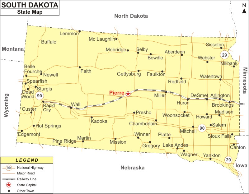
South Dakota Map: South Dakota is a state in the North Central region of the United States. South Dakota is the the 5th least populous and 17th largest U.S. state in area. It covers an area of 77,116 sq mi (199,729 km2), with population of 886,667 people as of 2020 Census.
Map of South Dakota with Cities, Road, River, Highways
 About Map: South Dakota Map showing the capital, state boundary, roads, rail network,rivers, interstate highways, major cities and towns.
South Dakota More Maps & Info
About South Dakota State Map
South Dakota Map: The state of South Dakota is located in the North Central part of the US. It is a portion of the Great Plains as well. Although South Dakota is the fifth least populous and fifth least densely populated state of the 50, it is the seventeenth largest state in terms of area. South Dakota shares borders with North Dakota in the north, Minnesota in east, Iowa in southeast, Nebraska in south, Wyoming in west and Montana in northwest. The map of South Dakota indicates all these borders. South Dakota is divided into two geographically and racially separate portions by the Missouri River, which is referred to by locals as "East River" and "West River." The largest city in South Dakota is Sioux Falls, while Pierre serves as the state capital. These cities can be seen clearly in the South Dakota map.
South Dakota Map
The detailed South Dakota map depicts the state's borders, the location of Pierre City, which is the state capital, significant cities and other populated regions, rivers and lakes, major highways, interstates, railroads, and airports. The South Dakota map on this website can be used for both educational and non-educational purposes. It is provided free of cost.
South Dakota Map Illustrates Major Cities
The major cities of South Dakota are shown in the map of South Dakota. Major cities like Aberdeen, Brookings, Huron, Mitchell, Pierre, Rapid City, Sioux Falls, Vermillion, Watertown, and Yankton can be identified in the South Dakota Map. The location of these cities and other towns is indicated in the map of South Dakota.
South Dakota Map Indicates National Highways & Routes of the State
The South Dakota map outlines all of the National Highways and Routes, which serve as the state's transportation network. The details of National Highways and Routes are provided below.
Facts About South Dakota
| State Name | South Dakota |
| Country | United States |
| Continent | North America |
| Capital City | Pierre |
| Largest city | Sioux Falls |
| Abbreviation | SD, US-SD |
| Joined the Union | November 2, 1889 (40th) |
| Nickname | The Mount Rushmore State |
| Area | 77,116 sq mi (199,905 km2) - Rank 17th |
| Timezone | eastern half Central: UTC -6/-5, western half Mountain: UTC -7/-6 |
| Population | 886,667 (2020 Census) - Rank 46th |
| Highest Point | Harney Peak |
| Lowest Point | Big Stone Lake on Minnesota border |
| Official Website | www.sd.gov |
