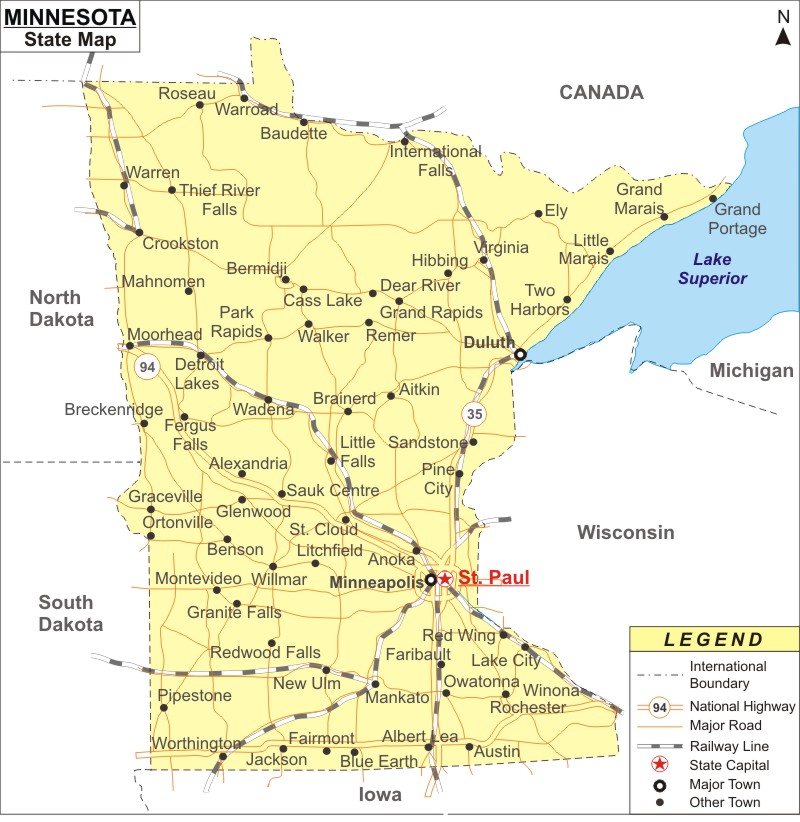
Minnesota Map: Minnesota is a state in the Midwestern region of the United States. It is the the 22nd most populous and 12th largest U.S. state in area. It covers an area of 86,935.83 sq mi (225,163 km2), with population of 5,706,494 people in the 2020 Census.
Map of Minnesota with Cities, Road, River, Highways
 About Map: Minnesota Map showing the capital, state boundary, roads, rail network,rivers, interstate highways, major cities and towns.
Minnesota More Maps & Info
About Minnesota State Map
The state of Minnesota is located in the upper Midwestern region of the US. The state shares borders with the Canadian provinces Ontario and Manitoba in the north, North and South Dakota in the west, Iowa in the south, and Wisconsin in the southeast. Minnesota map depicts all these borders. The state is 12th largest state in terms of area and 22nd most populous state with more than 5.75 million people living there. There are deciduous forests in the southeast of the state that have been partially cleared, cultivated, and settled. The state is renowned as the "Land of 10,000 Lakes'' because it has more than 14,000 freshwater lakes with at least ten acres in size, covering about a third of its land area. Since the Woodland period, which began in the eleventh century BCE, numerous indigenous peoples have made Minnesota home. The term Minnesota comes from the Dakota language.
Minnesota Map
The complete Minnesota map shows the state's boundaries, the location of the capital city, Saint Paul, major cities and other populated areas, rivers and lakes, important highways, interstates, railroads, and airports. The Minnesota Map provided on this page can be used for a variety of things, especially education.
Minnesota Map Illustrates Major Cities
Minnesota map shows the major cities of the state like Minneapolis, Saint Paul, Rochester, Bloomington, Duluth, Brooklyn Park, Plymouth, Woodbury, Maple Grove, and Blaine. Minnesota also the geographical locations of these cities as well other cities of the state as well. With the help of a Minnesota map, one can easily locate the city, town or area which one is searching for.
Minnesota Map Indicates National Highways & Routes of the State
The United States of America Highways and State Routes that are part of Minnesota transport system include Route 60, Route 70, Route 89, Route 89A, Route 93, Route 95, Route 160, Route 180 and Route 191.All these routes are indicated clearly by Minnesota map along with the National Highways.
Facts About Minnesota
| State Name | Minnesota |
| Country | United States |
| Continent | North America |
| Capital City | Saint Paul |
| Largest city | Minneapolis |
| Abbreviation | MN, Minn. US-MN |
| Joined the Union | May 11, 1858 (32nd) |
| Nickname | North Star State |
| Area | 86,939 sq mi (225,181 km2) |
| Timezone | Central: UTC −6/−5 |
| Population | 5,420,380 (2013 est) |
| Highest Point | Eagle Mountain |
| Lowest Point | Lake Superior |
| Official Website | https://mn.gov/ |
