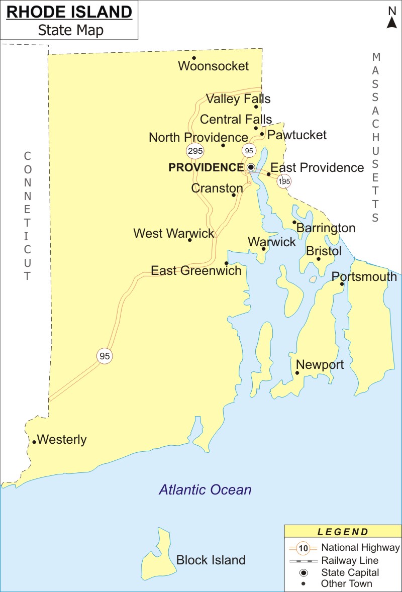
Rhode Island Map: Rhode Island is a state in the New England region of the United States. Rhode Island is It is the smallest U.S. state by area and the 7th least populous state. It covers an area of 1,214 sq mi (3,144 km2), with population of 1,097,379 people as of 2020 Census.
Map of Rhode Island with Cities, Road, River, Highways
 About Map: Rhode Island Map showing the capital, state boundary, roads, rail network,rivers, interstate highways, major cities and towns.
Rhode Island More Maps & Info
About Rhode Island State Map
State of Rhode Island is located in the Northeastern United States' New England region. It is the seventh-least populous U.S. state and the smallest state in terms of area. The Northeastern state of Rhode Island has a total area of 1,214 square miles (3,144 km2). Rhode Island shares borders with Massachusetts to the north and east, Connecticut to the west, and the Atlantic Ocean to the south via Block Island Sound and Rhode Island Sound. All these borders can be seen clearly in the Rhode Island map. Along with New York, it has a brief marine boundary. The capital and largest city in this region is Providence. Rhode Island, which goes by the moniker "Ocean State," features a number of oceanfront beaches.
Rhode Island Map
The detailed Rhode Island map depicts the state's boundaries, the location of the capital city, Providence, major cities and other populated areas, rivers and lakes, important highways, interstates, railroads, and airports. The Rhode Island map provided on this page can be used for a variety of things, especially education.
Rhode Island Map Illustrates Major Cities
Rhode Island map depicts major cities of the state like Providence, Warwick, Cranston, Pawtucket, Woonsocket, Tiverton, Portsmouth, Middletown, Narragansett, Barrington, East Greenwich, Valley Falls, Warren, North Smithfield, Greenville, Charlestown, Hopkinton, Exeter, Jamestown, Kingston, Pascoag, Foster, and other towns.
Rhode Island Map Indicates National Highways & Routes of the State
The Rhode Island map displays every National Highway and Route since they make up the state's transportation system. The information on National Highways and Routes is provided here.
Facts About Rhode Island
| State Name | Rhode Island |
| Country | United States |
| Continent | North America |
| Capital City | Providence |
| Largest city | Providence |
| Abbreviation | RI, US-RI |
| Joined the Union | May 29, 1790 (13th) |
| Nickname | The Plantation State, Little Rhody, The Ocean State |
| Area | 1,214 sq mi (3,144 km2) - Rank 50th |
| Timezone | Eastern: UTC −5/−4 |
| Population | 1,097,379 (2020 Census) |
| Highest Point | Jerimoth Hill |
| Lowest Point | Atlantic Ocean |
| Official Website | www.ri.gov |
