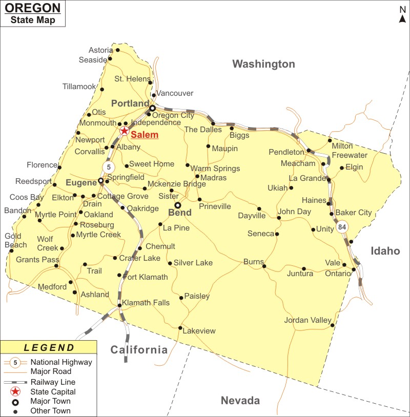
Oregon Map: Oregon is a state in the Pacific Northwest region of the United States. Oregon is the the 27th most populous and 9th largest U.S. state in area. It covers an area of 98,381 sq mi (254,806 km2), with population of 4,246,155[ residents as of 2020 Census.
Map of Oregon with Cities, Road, River, Highways
 About Map: Oregon Map showing the capital, state boundary, roads, rail network,rivers, interstate highways, major cities and towns.
Oregon More Maps & Info
About Oregon State Map
The state of Oregon is located in the Pacific Northwest of the country. A large portion of Oregon's northern boundary with Washington is defined by the Columbia River, while a large portion of its eastern boundary with Idaho is defined by the Snake River. The border with California and Nevada is marked by the 42° north parallel. The Pacific Ocean defines the western border. Oregon is currently the ninth-largest and 27th-most populous U.S. state, with 4 million people living there across 98,000 square miles (250,000 km2). With 169,798 inhabitants, Salem, the state capital, is Oregon's second-largest city. Portland is the largest city in the state. The map of Oregon shows these two cities along with the other towns and cities too.
Oregon Map
The detailed Oregon map shows the state's borders, the location of Salem, the state capital, as well as significant cities and other populated areas, rivers and lakes, vital highways, interstates, and railroads. It also shows the state's major rivers and lakes. The Oregon map that is offered on this page can be downloaded. It is free.
Oregon Map Illustrates Major Cities
City of the Dalles, Coos Bay, Corvallis, Dallas, Eugene, Grants Pass, Gresham, Hermiston, Hillsboro, Keizer, Klamath Falls, La Grange, Lake Oswego, Lebanon, McMinnville, Medford, Milwaukie, Newberg, Ontario, Oregon City, Pendleton, Portland, Redmond, Roseburg, Salem, Springfield, Tigard, Troutdale, and Woodburn are among the other cities that make up Oregon State. All these cities and towns can be located in the map of Oregon.
Oregon Map Indicates National Highways & Routes of the State
Oregon map shows all the National Highways and Routes, that are part and parcel of transport system of the State. Details about the national highways and routes of Oregon are given below.
Facts About Oregon
| State Name | Oregon |
| Country | United States |
| Continent | North America |
| Capital City | Salem |
| Largest city | Portland |
| Abbreviation | OR, Ore. US-OR |
| Joined the Union | February 14, 1859 (33rd) |
| Nickname | Beaver State |
| Area | 98,381 sq mi (255,026 km2) |
| Timezone | most of state Pacific: UTC −8/−7, most of Malheur County Mountain: UTC −7/−6 |
| Population | 4,246,155 (2020) - Rank 27th |
| Highest Point | Mount Hood |
| Lowest Point | Pacific Ocean |
| Official Website | www.oregon.gov |
