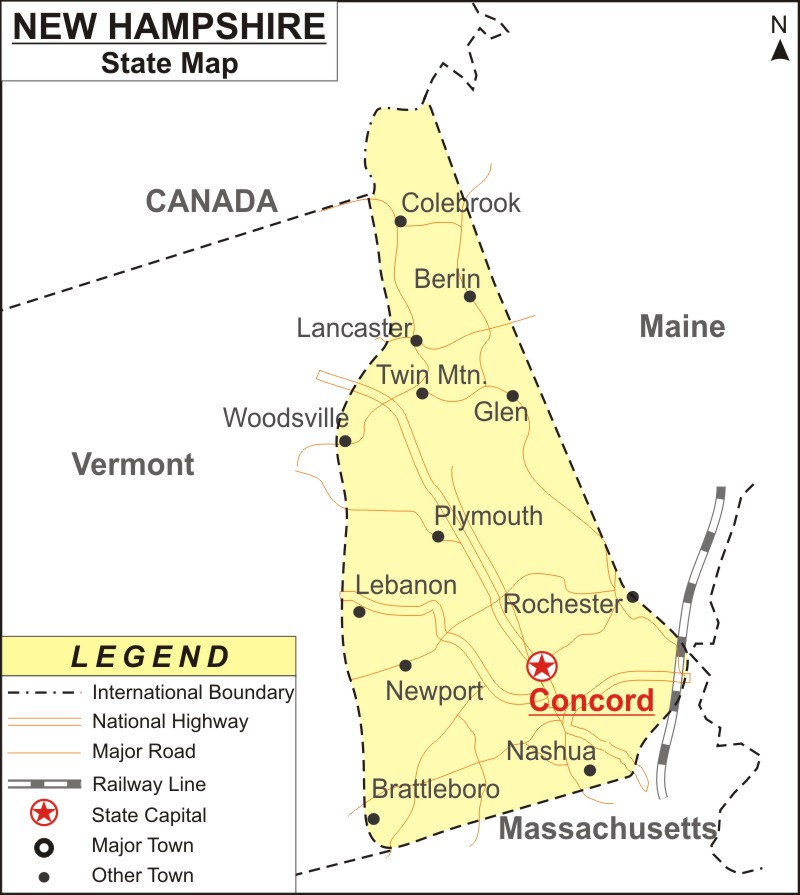
New Hampshire Map: New Hampshire is a state in the New England region of the Northeastern United States. It is bordered by Maine and the Gulf of Maine to the east; Massachusetts to the south; Vermont to the west and Quebec, in Canada to the north and northwest.
Map of New Hampshire with Cities, Road, River, Highways
 About Map: New Hampshire Map showing the capital, state boundary, roads, rail network,rivers, interstate highways, major cities and towns.
New Hampshire More Maps & Info
About New Hampshire State Map
The state of New Hampshire is located in the Northeastern United States' New England region. It shares borders with the Canadian provinces of Quebec to the north, Massachusetts to the south, Vermont to the west, Maine and the Gulf of Maine to the east. All these borders can be clearly seen in the New Hampshire map. New Hampshire is the tenth least populated of the 50 states in the United States and has slightly more than 1.3 million citizens, making it the fifth smallest state in terms of area. Manchester is the biggest city in the state, whereas Concord is its capital. New Hampshire Map is provided on this page.
New Hampshire Map
New Hampshire Map depicts the state's borders, the location of Concord City, which is the state capital, major cities and other populated areas, rivers and lakes, major highways, interstates, railroads, and airports. You can download the map of New Hampshire from this page and use it for your purpose.
New Hampshire Map Indicates Major Cities and Towns:
New Hampshire Map also shows the major cities as well as the towns of the state. Cities like Manchester, Nashua, Concord, Derry, Dover, Rochester, Claremont, Woodsville, Berlin, Milford, Conway, Laconia, Exeter, Plymouth, Franklin, Hanover, Keene, Lebanon, Littleton, Portsmouth, and Lancaster can be seen in the map of New Hampshire.
New Hampshire Map Illustrates National Highways & Routes of the State:
All of the National Highways and Routes of the state are depicted on the New Hampshire map, as they are the State's transportation network. The details of National Highways and Routes are mentioned below.
Facts About New Hampshire
| State Name | New Hampshire |
| Country | United States |
| Continent | North America |
| Capital City | Concord |
| Largest city | Manchester |
| Abbreviation | NH, N.H. US-NH |
| Joined the Union | -40733 |
| Nickname | The Granite State |
| Area | 9,349 sq mi (24,214[4] km2) - 46th Rank |
| Timezone | UTC-5/-4 |
| Population | 1,377,529 (2020 Census) - 41st Rank |
| Highest Point | Mount Washington |
| Lowest Point | Atlantic Ocean |
| Official Website | www.nh.gov |
