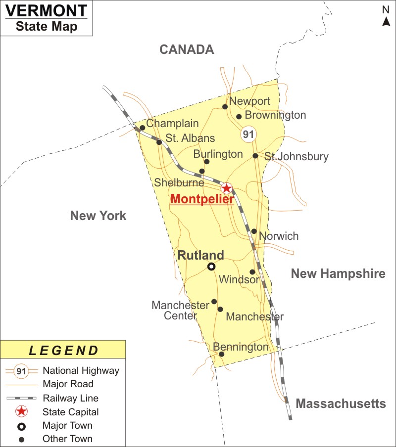
Vermont Map: Vermont is a state in the New England region of the Northeastern United States. Vermont is the the 2nd least-populated in the U.S. after Wyoming and 6th smallest state by area.It covers an area of 9,616 sq mi (24,923 km2), with population of 643,503 people According to the 2020 U.S. census
Map of Vermont with Cities, Road, River, Highways
 About Map: Vermont Map showing the capital, state boundary, roads, rail network,rivers, interstate highways, major cities and towns.
Vermont More Maps & Info
About Vermont State Map
The state of Vermont is located in the Northeastern United States' New England region. Vermont has borders with Massachusetts to the south, New Hampshire to the east, New York to the west, and Quebec to the north. The state is the only state in New England that is not bordered by the Atlantic Ocean. The state is second least inhabited in the US after Wyoming. The sixth-smallest state in terms of area in the country is Vermont. The capital city of the state is Montpelier, which is the least populous state capital in the United States. Burlington is the most populous city in the state.
Vermont Map
The Vermont map provided on this page depicts all of the areas in the state. Vermont Map shows not only the state borders, but also major highways, roads, railway lines, the state capital, and other towns. The Vermont Map can be used to determine the orientation of locations. The Vermont Map on this website is provided for free. It is available for free download.
Vermont Map Illustrates Major Cities
The Vermont major cities are denoted on the Vermont map. The major cities and other cities of the state such as Burlington, Essex, Colchester, Rutland, Bennington, Brattleboro, Hartford, Montpelier, Barre, Bellows Falls, Bethel, Hyde Park, Middlebury, Newport, Northfield, South, Burlington, Springfield, St Albans, Island Pond, Ludlow, Manchester, Johns bury, Swanton, Vergennes, Winooski, Woodstock, Waterbury, White River Jct and Windsor can be located on Vermont map.
Vermont Map Indicates National Highways & Routes of the State
Vermont map indicates the National Highways and Routes of Vermont. The details of National Highways and Routes are mentioned below.
Facts About Vermont
| State Name | Vermont |
| Country | United States |
| Continent | North America |
| Capital City | Montpelier |
| Largest city | Burlington |
| Abbreviation | VT, US-VT |
| Joined the Union | March 4, 1791 (14th) |
| Nickname | The Green Mountain State |
| Area | 9,616 sq mi (24,923 km2) - 45th Rank |
| Timezone | Eastern: UTC −5/−4 |
| Population (2020) | 643,503 - 49th Rank in U.S. |
| Highest Point | Mount Mansfield |
| Lowest Point | Lake Champlain |
| Official Website | www.vermont.gov |
