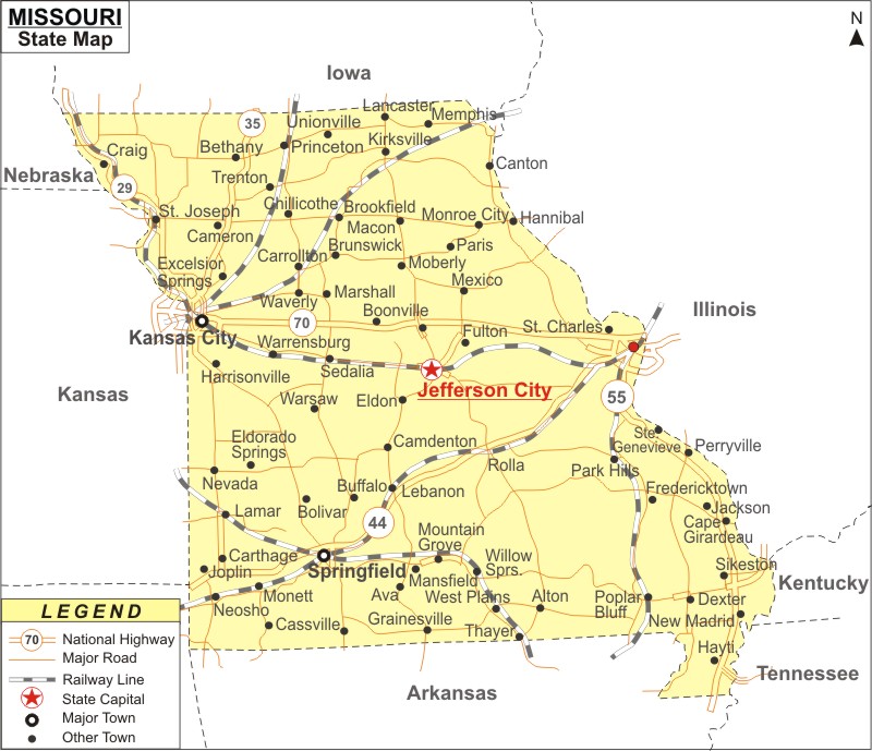
Missouri Map: Missouri is a state in the Midwestern region of the United States. Missouri is the the 19th most populous and 21st largest U.S. state in area. It covers an area of 69,715 sq mi (180,560 km2), with population of 6,154,913 residents in the 2020 Census.
Map of Missouri with Cities, Road, River, Highways
 About Map: Missouri Map showing the capital, state boundary, roads, rail network,rivers, interstate highways, major cities and towns.
Missouri More Maps & Info
About Missouri State Map
The state of Missouri is located in the Midwest part of the USA. Its eight bordering states are Iowa to the north, Illinois, Kentucky, and Tennessee to the east, Arkansas to the south, and Oklahoma, Kansas, and Nebraska to the west. These borders can be seen in the Missouri map provided here. It ranks 21st in terms of land area. The Mississippi River forms the eastern border of the state. It is formed by the Missouri River, for which the state is called. It is the 19th most populous state in the nation with more than six million citizens. The capital is Jefferson City, and the main cities are St. Louis, Kansas City, Springfield, and Columbia.
Missouri Map
The beautifully detailed Missouri map shows the state's borders, the location of Jefferson City, the state capital, significant cities and other populated regions, rivers and lakes, significant highways, interstates, railroads, and airports. The Missouri map provided on this website can be used for both educational and non-educational purposes.
Missouri Map Illustrates Major Cities
The major cities of Missouri are shown in the Missouri map. The major cities of the state are St. Louis, Springfield, Jefferson City, Independence, Kansas City, Cape Girardeau, Columbia, Joplin, St. Charles, Bethany, Bolivar, Bowling Green, St. Joseph, Lees Summit, Florissant, Liberty Gladstone, Raytown, Oakville, Brookfield, Cameron, Kirksville, Lebanon, Macon, Malden, Carrolllton, Carthage, Chillicothe, Clinton, Dexter, Farmington, Festus, Fredericktown, Fulton, Hannibal, and Harrisonville. Missouri map also indicates the location of these places where they are located.
Missouri Map Indicates National Highways & Routes of the State
The Missouri map depicts all of the National Highways and Routes, as they are the State's transportation network. The details of National Highways and Routes are provided below.
Facts About Missouri
| State Name | Missouri |
| Country | United States |
| Continent | North America |
| Capital City | Jefferson City |
| Largest city | Kansas City |
| Abbreviation | MO, US-MO |
| Joined the Union | August 10, 1821 (24th) |
| Nickname | Show-Me State |
| Area | 69,709 sq mi (180,533 km2) |
| Timezone | Central: UTC −6/−5 |
| Population | 6,154,913 (2020 Census) |
| Highest Point | Taum Sauk Mountain |
| Lowest Point | Saint Francis River at southern Arkansas border |
| Official Website | https://www.mo.gov/ |
