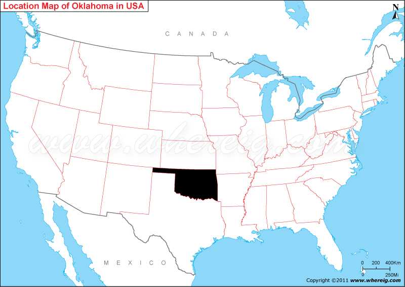
Oklahoma was one of the newest states that enlisted in the union; it is 46th state that enters in the United States of America. The largest and capital city of Oklahoma is Oklahoma City. Other important cities are – Tulsa, Norman, Lawton, Broken Arrow, and Edmond.
The economy of the state is largely depends upon the agriculture, oil and natural gas. Other important sectors are aviation, telecommunications, energy, and biotechnology. The capita city Oklahoma City and Tulsa are the main economic center of the state. Geographically, state has small mountain ranges; however, most of the parts lie in the Great Plains and Interior Highlands. Furthermore, the climate type of Oklahoma is continental.
Oklahoma State - Quick Facts
| Country: | United States |
| Region Type: | State |
| Capital: | Oklahoma City |
| Abbreviation: | OK, Okla. US-OK |
| Largest City: | Oklahoma City |
| Area: | 69,898sqmi (181,195km) |
| Population: | 3,850,568 (2013 est) |
| Joined The Union: | 2877 |
| Nickname: | Sooner State |
| Highest Point: | Black Mesa |
| Lowest Point: | Little River at Arkansas border |
| Timezone: | UTC-7/-6 all of the state (legally) Central: UTC -6/-5, Kenton (informally) Mountain: UTC -7/-6 |
| Official Website: | www.ok.gov |
Location Map of USA with States
- Where is Alabama (AL)
- Where is Alaska
- Where is Arizona
- Where is Arkansas Location Mapp
- Where is California
- Where is Colorado
- Where is Connecticut
- Where is Delaware
- Where is Florida
- Where is Georgia
- Where is Hawaii
- Where is Idaho State Map
- Where is Illinois
- Where is Indiana
- Where is Iowa
- Where is Kansas
- Where is Kentucky
- Where is Louisiana
- Where is Maine
- Where is Maryland
- Where is Massachusetts
- Where is Michigan
- Where is Minnesota
- Where is Mississippi
- Where is Missouri
- Where is Montana
- Where is Nebraska
- Where is Nevada
- Where is New Hampshire
- Where is New Jersey
- Where is New Mexico
- Where is New York
- Where is North Carolina
- Where is North Dakota
- Where is Ohio
- Where is Oklahoma
- Where is Oregon
- Where is Pennsylvania
- Where is Rhode Island
- Where is South Carolina
- Where is South Dakota
- Where is Tennessee
- Where is Texas
- Where is Utah
- Where is Vermont
- Where is Virginia
- Where is Washington
- Where is West Virginia
- Where is Wisconsin
- Where is Wyoming


