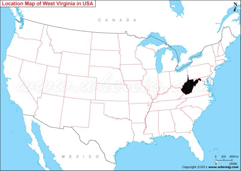
Map showing Location of West Virginia on the US map.
Charleston is the capital and largest city of West Virginia. Historically, West Virginia was the only state that formed by seceding from a Confederate state; it was also one of only two states that formed during the American Civil War.
Geographically, the state is noted for its mountains and diverse topography. Surprisingly, West Virginia is one of the most densely karstic areas in the world, which facilitates it as a choice area for recreational caving and scientific research. With the humid subtropical climate, it is also known for a wide range of outdoor recreational activities including skiing, whitewater rafting, hiking, mountain biking, fishing, and hunting.
Most Viewed Links
| West Virginia Map | Counties in West Virginia | Cities in West Virginia |
| West Virginia Zipcodes | Airports in West Virginia | West Virginia Area Codes |
Where is West Virginia Located?
As shown in the given West Virginia location map that Virginia is located in the north-east part of the United States. West Virginia is a state in the Appalachian region. The state shares its border with Virginia in the south-east, Kentucky to the south-west, Ohio in the north-west, Pennsylvania in the north-east and Maryland in the east.Charleston is the capital and largest city of West Virginia. Historically, West Virginia was the only state that formed by seceding from a Confederate state; it was also one of only two states that formed during the American Civil War.
Geographically, the state is noted for its mountains and diverse topography. Surprisingly, West Virginia is one of the most densely karstic areas in the world, which facilitates it as a choice area for recreational caving and scientific research. With the humid subtropical climate, it is also known for a wide range of outdoor recreational activities including skiing, whitewater rafting, hiking, mountain biking, fishing, and hunting.
West Virginia State - Quick Facts
| Country: | United States |
| Region Type: | State |
| Capital: | Charleston |
| Abbreviation: | WV, US-WV |
| Largest City: | Charleston |
| Area: | 24,230 sq mi (62,755 km2) |
| Population: | 1,793,716 (2020 Census) |
| Joined The Union: | -13342 |
| Nickname: | Mountain State |
| Highest Point: | Spruce Knob |
| Lowest Point: | Potomac River at Virginia border |
| Timezone: | Eastern: UTC -5/-4 |
| Official Website: | https://www.wv.gov/Pages/default.aspx |
Location Map of USA with States
- Where is Alabama (AL)
- Where is Alaska
- Where is Arizona
- Where is Arkansas Location Mapp
- Where is California
- Where is Colorado
- Where is Connecticut
- Where is Delaware
- Where is Florida
- Where is Georgia
- Where is Hawaii
- Where is Idaho State Map
- Where is Illinois
- Where is Indiana
- Where is Iowa
- Where is Kansas
- Where is Kentucky
- Where is Louisiana
- Where is Maine
- Where is Maryland
- Where is Massachusetts
- Where is Michigan
- Where is Minnesota
- Where is Mississippi
- Where is Missouri
- Where is Montana
- Where is Nebraska
- Where is Nevada
- Where is New Hampshire
- Where is New Jersey
- Where is New Mexico
- Where is New York
- Where is North Carolina
- Where is North Dakota
- Where is Ohio
- Where is Oklahoma
- Where is Oregon
- Where is Pennsylvania
- Where is Rhode Island
- Where is South Carolina
- Where is South Dakota
- Where is Tennessee
- Where is Texas
- Where is Utah
- Where is Vermont
- Where is Virginia
- Where is Washington
- Where is West Virginia
- Where is Wisconsin
- Where is Wyoming


