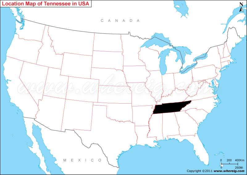
Know Where is Tennessee located on the US map.
Geographically, the Appalachian Mountains greatly cover the eastern part of the state; on the contrary, the Mississippi River makes the state's western border. The capital city of Tennessee is Nashville; however, the largest city of the state is Memphis.
The state’s significant industries are agriculture, manufacturing, and tourism; likewise, the state exports chemicals, electrical equipment, and transportation equipment. Furthermore, in the humid subtropical type of climate, the major agriculture products are soybeans, poultry, and cattle.
Major cities of Tennessee are – Chattanooga, Clarksville, Knoxville, Memphis, Murfreesboro, and Nashville.
Where is Tennessee Located?
As shown in the given Tennessee location map that Tennessee is located in the south-eastern region of the United States. Tennessee map also shows that it shares its border with Kentucky in the north, Missouri in the north-west, Arkansas in the south-west, Mississippi, Alabama, and Georgia in the south, North Carolina in the east, and Virginia in the north-east.Geographically, the Appalachian Mountains greatly cover the eastern part of the state; on the contrary, the Mississippi River makes the state's western border. The capital city of Tennessee is Nashville; however, the largest city of the state is Memphis.
The state’s significant industries are agriculture, manufacturing, and tourism; likewise, the state exports chemicals, electrical equipment, and transportation equipment. Furthermore, in the humid subtropical type of climate, the major agriculture products are soybeans, poultry, and cattle.
Major cities of Tennessee are – Chattanooga, Clarksville, Knoxville, Memphis, Murfreesboro, and Nashville.
Tennessee State - Quick Facts
| Country: | United States |
| Region Type: | State |
| Capital: | Nashville |
| Abbreviation: | TN, Tenn. US-TN |
| Largest City: | Memphis |
| Area: | 42,143 sq mi (109,247 km2) |
| Population: | 6,910,840 (2020 Census) |
| Joined The Union: | -37831 |
| Nickname: | The Volunteer State |
| Highest Point: | Clingmans Dome |
| Lowest Point: | Mississippi River at Mississippi border |
| Timezone: | East Tennessee Eastern: UTC -5/-4, Middle and West Central: UTC -6/-5 |
| Official Website: | www.tennessee.gov |
Tennessee More Maps & Info
Location Map of USA with States
- Where is Alabama (AL)
- Where is Alaska
- Where is Arizona
- Where is Arkansas Location Mapp
- Where is California
- Where is Colorado
- Where is Connecticut
- Where is Delaware
- Where is Florida
- Where is Georgia
- Where is Hawaii
- Where is Idaho State Map
- Where is Illinois
- Where is Indiana
- Where is Iowa
- Where is Kansas
- Where is Kentucky
- Where is Louisiana
- Where is Maine
- Where is Maryland
- Where is Massachusetts
- Where is Michigan
- Where is Minnesota
- Where is Mississippi
- Where is Missouri
- Where is Montana
- Where is Nebraska
- Where is Nevada
- Where is New Hampshire
- Where is New Jersey
- Where is New Mexico
- Where is New York
- Where is North Carolina
- Where is North Dakota
- Where is Ohio
- Where is Oklahoma
- Where is Oregon
- Where is Pennsylvania
- Where is Rhode Island
- Where is South Carolina
- Where is South Dakota
- Where is Tennessee
- Where is Texas
- Where is Utah
- Where is Vermont
- Where is Virginia
- Where is Washington
- Where is West Virginia
- Where is Wisconsin
- Where is Wyoming


