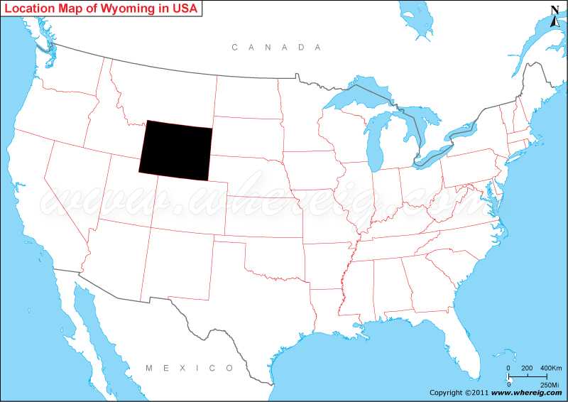
Map showing location of Wyoming on the US map.
As shown in the given Wyoming location map that Wyoming is located in the central-west part of the US. Wyoming is a state in the Mountain region; most of the western part of Wyoming State is covered with the mountain ranges and hills in the foothills of the Eastern Rocky Mountains.
However, the eastern part of the state is high elevation prairie known as the High Plains. In terms of area, Wyoming is the 10th largest state in the United States but in terms of population, it is the least populous states. The capital city of Wyoming is Cheyenne. Cheyenne is the most populous city of Wyoming.
The climate of Wyoming ranges from continental to semi-arid. Geographically, the state shares its border with Montana in the north, South Dakota and Nebraska in the east, Colorado in the south, Utah in the south-west, and Idaho in the west. One of the most famous national park i.e. Yellowstone National Park is located in Wyoming. For the tourism purpose, the state has several landscapes to visit.
Where is Wyoming State Located?
As shown in the given Wyoming location map that Wyoming is located in the central-west part of the US. Wyoming is a state in the Mountain region; most of the western part of Wyoming State is covered with the mountain ranges and hills in the foothills of the Eastern Rocky Mountains.
However, the eastern part of the state is high elevation prairie known as the High Plains. In terms of area, Wyoming is the 10th largest state in the United States but in terms of population, it is the least populous states. The capital city of Wyoming is Cheyenne. Cheyenne is the most populous city of Wyoming.
The climate of Wyoming ranges from continental to semi-arid. Geographically, the state shares its border with Montana in the north, South Dakota and Nebraska in the east, Colorado in the south, Utah in the south-west, and Idaho in the west. One of the most famous national park i.e. Yellowstone National Park is located in Wyoming. For the tourism purpose, the state has several landscapes to visit.
Wyoming State - Quick Facts
| Country: | United States |
| Region Type: | State |
| Capital: | Cheyenne |
| Abbreviation: | WY, US-WY |
| Largest City: | Cheyenne |
| Area: | 97,814 sq mi (253,348 km2) |
| Population: | 576,851 (2020 Census) |
| Joined The Union: | -3460 |
| Nickname: | Cowboy State, Big Wyoming, Equality State |
| Highest Point: | Gannett Peak |
| Lowest Point: | Belle Fourche River at South Dakota border |
| Timezone: | Mountain: UTC -7/-6 |
| Official Website: | wyoming.gov |
Location Map of USA with States
- Where is Alabama (AL)
- Where is Alaska
- Where is Arizona
- Where is Arkansas Location Mapp
- Where is California
- Where is Colorado
- Where is Connecticut
- Where is Delaware
- Where is Florida
- Where is Georgia
- Where is Hawaii
- Where is Idaho State Map
- Where is Illinois
- Where is Indiana
- Where is Iowa
- Where is Kansas
- Where is Kentucky
- Where is Louisiana
- Where is Maine
- Where is Maryland
- Where is Massachusetts
- Where is Michigan
- Where is Minnesota
- Where is Mississippi
- Where is Missouri
- Where is Montana
- Where is Nebraska
- Where is Nevada
- Where is New Hampshire
- Where is New Jersey
- Where is New Mexico
- Where is New York
- Where is North Carolina
- Where is North Dakota
- Where is Ohio
- Where is Oklahoma
- Where is Oregon
- Where is Pennsylvania
- Where is Rhode Island
- Where is South Carolina
- Where is South Dakota
- Where is Tennessee
- Where is Texas
- Where is Utah
- Where is Vermont
- Where is Virginia
- Where is Washington
- Where is West Virginia
- Where is Wisconsin
- Where is Wyoming


