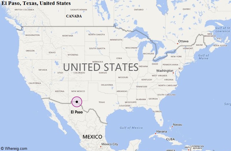
El Paso is located in the western part of the Texas state, United States. It is the sixth most populous city in the state of Texas.
| Sr. No | Fact sheet | El Paso |
|---|---|---|
| 1 | Country | USA |
| 2 | State | Texas |
| 3 | Location | Western part of the State |
| 4 | Latitude | 31º47’25”N |
| 5 | Longitude | 106º25’24”W |
| 6 | Total area | 663.5km2 ( 256 sq mi ) |
| 7 | Total Population | 665,568 |
| 8 | Zip Codes Code | 79900 |
| 9 | Area Code | 915 |
| 10 | Nearby Cities | Horizon City, Socorro City, Ciudad Juarez |
| 11 | Major Tourists' Attraction | Fort Bliss, Cathedral of Saint Patrick, Chamizal National Memorial, Magoffin Home State Historic Site |
| 12 | Nearest airport | Abraham Gonzalez International Airport (about 11 miles), El Paso International Airport (13 miles) |
Most Viewed Links
US Cities Location
- Where is Akron
- Where is Anaheim
- Where is Anchorage
- Where is Arlington
- Where is Aurora
- Where is Baltimore
- Where is Baton Rouge
- Where is Birmingham
- Where is Boise City
- Where is Boston
- Where is Buffalo
- Where is Chandler
- Where is Charlotte
- Where is Chesapeake
- Where is Chula Vista
- Where is Cincinnati
- Where is Cleveland
- Where is Colorado Springs
- Where is Columbus
- Where is Corpus Christi
- Where is Des Moines
- Where is Detroit
- Where is Durham
- Where is El Paso
- Where is Fayetteville
- Where is Fort Wayne
- Where is Freemont
- Where is Fresno
- Where is Garland
- Where is Gilbert
- Where is Glendale
- Where is Greensboro
- Where is Henderson
- Where is Hialeah
- Where is Honolulu
- Where is Houston
- Where is Indianapolis
- Where is Irvine
- Where is Irving
- Where is Jacksonville
- Where is Jersey City
- Where is Kansas City
- Where is Laredo
- Where is Lincoln
- Where is Long Beach
- Where is Louisville
- Where is Lubbock
- Where is Madison
- Where is Memphis
- Where is Mesa
- Where is Milwaukee
- Where is Minneapolis
- Where is Modesto
- Where is Montgomery
- Where is Nashville
- Where is Newark
- Where is Norfolk
- North Las Vegas
- Oakland
- Oklahoma City
- Where is Omaha
- Where is Orlando
- Where is Paradise
- Where is Philadelphia
- Where is Phoenix
- Where is Portland
- Where is Raleigh
- Where is Reno
- Where is Richmond
- Where is Riverside
- Where is Rochester
- Where is Sacramento
- Where is Saint Paul
- Where is Saint Petersburg
- Where is San Bernardino
- Where is San Jose
- Where is Santa Ana
- Where is Scottsdale
- Where is Shreveport
- Where is Spokane
- Where is St Louis
- Where is Stockton
- Where is Tampa
- Where is Toledo
- Where is Tucson
- Where is Tulsa
- Where is Virginia Beach
- Where is Wichita


