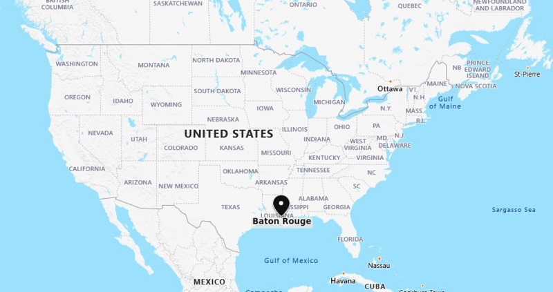
Baton Rouge is located in the eastern part of the Louisiana, United States. It is the capital city of the state Louisiana. It is the second largest city in the state by population.
| Sr. No | Fact sheet | Baton Rouge |
|---|---|---|
| 1 | Country | USA |
| 2 | State | Louisiana |
| 3 | Location | Eastern part of the State |
| 4 | Latitude | 30.27′29″N |
| 5 | Longitude | 91.8′25″W |
| 6 | Total area | 204.8km2 ( 79.1 sq mi ) |
| 7 | Total Population | 230,139 |
| 8 | Zip Codes | 70801 |
| 9 | Area code | 225 |
| 10 | Nearby Cities | Shenandoah, Merrydale, New Orleans, Denham Springs |
| 11 | Major Tourists' Attraction | Louisiana State Capitol, Shaw Center for the Arts, Pentagon Barracks, Shaw Center for the Arts |
| 12 | Nearest airport | Baton Rouge Metropolitan Airport (about 8 miles) |
More Louisiana Maps & Info
US Cities Location
- Where is Akron
- Where is Anaheim
- Where is Anchorage
- Where is Arlington
- Where is Aurora
- Where is Baltimore
- Where is Baton Rouge
- Where is Birmingham
- Where is Boise City
- Where is Boston
- Where is Buffalo
- Where is Chandler
- Where is Charlotte
- Where is Chesapeake
- Where is Chula Vista
- Where is Cincinnati
- Where is Cleveland
- Where is Colorado Springs
- Where is Columbus
- Where is Corpus Christi
- Where is Des Moines
- Where is Detroit
- Where is Durham
- Where is El Paso
- Where is Fayetteville
- Where is Fort Wayne
- Where is Freemont
- Where is Fresno
- Where is Garland
- Where is Gilbert
- Where is Glendale
- Where is Greensboro
- Where is Henderson
- Where is Hialeah
- Where is Honolulu
- Where is Houston
- Where is Indianapolis
- Where is Irvine
- Where is Irving
- Where is Jacksonville
- Where is Jersey City
- Where is Kansas City
- Where is Laredo
- Where is Lincoln
- Where is Long Beach
- Where is Louisville
- Where is Lubbock
- Where is Madison
- Where is Memphis
- Where is Mesa
- Where is Milwaukee
- Where is Minneapolis
- Where is Modesto
- Where is Montgomery
- Where is Nashville
- Where is Newark
- Where is Norfolk
- North Las Vegas
- Oakland
- Oklahoma City
- Where is Omaha
- Where is Orlando
- Where is Paradise
- Where is Philadelphia
- Where is Phoenix
- Where is Portland
- Where is Raleigh
- Where is Reno
- Where is Richmond
- Where is Riverside
- Where is Rochester
- Where is Sacramento
- Where is Saint Paul
- Where is Saint Petersburg
- Where is San Bernardino
- Where is San Jose
- Where is Santa Ana
- Where is Scottsdale
- Where is Shreveport
- Where is Spokane
- Where is St Louis
- Where is Stockton
- Where is Tampa
- Where is Toledo
- Where is Tucson
- Where is Tulsa
- Where is Virginia Beach
- Where is Wichita
| (adsbygoogle = window.adsbygoogle || []).push({}); |


