Montgomery, Alabama Quick Facts
| Fact | Details |
|---|---|
| City | Montgomery |
| County | Montgomery County |
| State | Alabama |
| State Capital | Montgomery |
| US Region | South |
| Latitude | 32.3668° N |
| Longitude | 86.3000° W |
| Elevation | 220 ft (67 m) |
| Land Area | 159.8 sq mi |
| Water Area | 2.2 sq mi |
| Total Area | 162.0 sq mi |
| Population (2020 Census) | 200,603 |
| Population Density | Approximately 1,255 per sq mi |
| ZIP Codes | 36101, 36104, 36105, 36106, 36107, 36108, 36109, 36110, 36111, 36112, 36113, 36114, 36115, 36116, 36117 |
| Area Code | 334 |
| Time Zone Standard | Central Standard Time (CST, UTC-6) |
| Time Zone Daylight | Central Daylight Time (CDT, UTC-5) |
| Currency | US Dollar (USD) |
| FIPS Code | 01-51000 |
| Congressional District | Alabama 2nd Congressional District |
Location and Surroundings
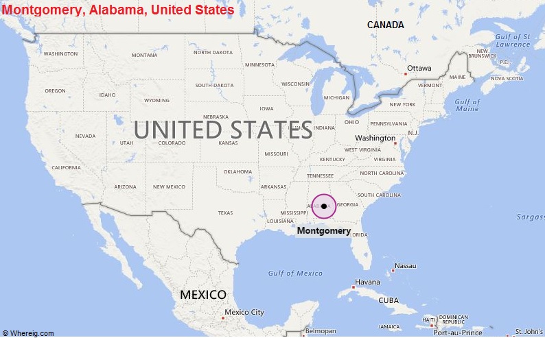
Montgomery is located in Montgomery County in south-central Alabama along the Alabama River. It lies between Prattville to the northwest and Pike Road to the east while serving as the state capital and a major regional center. The city is famous for its role in the Civil Rights Movement, state government, military installations, and historic landmarks.
Nearby Cities to Montgomery, Alabama
- Prattville, Alabama - 12 mi Northwest
- Pike Road, Alabama - 14 mi East
- Millbrook, Alabama - 13 mi North
- Wetumpka, Alabama - 18 mi Northeast
- Tallassee, Alabama - 33 mi East
- Selma, Alabama - 50 mi West
- Troy, Alabama - 51 mi Southeast
- Auburn, Alabama - 57 mi East
- Opelika, Alabama - 62 mi East
- Greenville, Alabama - 44 mi South
Montgomery, Alabama Climate and Weather Overview
| Month | Avg High (°F) | Avg Low (°F) | Avg Rainfall (in) |
|---|---|---|---|
| January | 58 | 37 | 4.9 |
| April | 78 | 54 | 3.8 |
| July | 92 | 73 | 4.7 |
| October | 80 | 56 | 2.8 |
| Annual | 77 | 55 | 51.7 |
| Climate Attribute | Details |
|---|---|
| Climate Classification (Köppen) | Humid Subtropical (Cfa) |
| Annual Rainfall | About 52 inches |
| Annual Sunshine Days | Approximately 217 days |
| Hurricane/Tornado Risk | Moderate tornado risk, occasional tropical storm impacts |
| Snowfall | Less than 1 inch annually |
Driving Distances from Montgomery, Alabama
| City | State | Distance (mi) | Approx. Drive Time |
|---|---|---|---|
| Prattville | Alabama | 12 | 15 min |
| Millbrook | Alabama | 13 | 20 min |
| Wetumpka | Alabama | 18 | 25 min |
| Auburn | Alabama | 57 | 1 hr |
| Selma | Alabama | 50 | 55 min |
| Troy | Alabama | 51 | 55 min |
| Opelika | Alabama | 62 | 1 hr 5 min |
| Birmingham | Alabama | 92 | 1 hr 35 min |
| Dothan | Alabama | 106 | 1 hr 50 min |
| Mobile | Alabama | 170 | 2 hr 40 min |
Transportation and Connectivity in Montgomery, Alabama
| Category | Details |
|---|---|
| Airport Name | Montgomery Regional Airport |
| IATA Code | MGM |
| Port | Port of Montgomery |
| Major Highways | I-65, I-85, US 31, US 80, US 82, US 231 |
| Train/Amtrak Service | No direct Amtrak service |
| Local Bus/Transit Service | Montgomery Area Transit System (MATS) |
- Interstate 65 - Major north-south corridor connecting Montgomery with Birmingham and Mobile.
- Interstate 85 - Connects Montgomery with Atlanta and eastern Alabama.
- US Route 80 - Historic east-west route across central Alabama.
- US Route 231 - Important highway connecting Montgomery with Dothan and Tennessee.
- US Route 31 - Regional route through central Alabama.
- US Route 82 - Connects Montgomery with western and southeastern Alabama.
Key Landmarks and Places to Visit in Montgomery, Alabama
| Landmark Name | Type |
|---|---|
| Alabama State Capitol | Historic Landmark |
| Rosa Parks Museum | Museum |
| The Legacy Museum | Museum |
| National Memorial for Peace and Justice | Memorial |
| Old Alabama Town | Historic Site |
| Montgomery Zoo | Zoo |
| Riverfront Park | Park |
| First White House of the Confederacy | Historic Site |
| Hank Williams Museum | Museum |
| Blount Cultural Park | Urban Park |
Waterbodies in Montgomery, Alabama
Alabama River, Catoma Creek, Swift Creek, Ramer Creek, Channahatchee Creek, Pintlala Creek, Lake Jackson, Jordan Lake, Cypress Pond, Caney Creek
Golf Courses in Montgomery, Alabama
Capitol Hill Golf Course, Lagoon Park Golf Course, Arrowhead Country Club, Wynlakes Golf and Country Club, Gateway Golf Course, Quail Walk Golf Course, Emerald Mountain Golf Club, Montgomery Country Club, RTJ Golf Trail Capitol Hill, Auburn University Club Montgomery Area
Economy and Major Employers in Montgomery, Alabama
| Sector | Major Employer or Industry | Notes |
|---|---|---|
| Government | State of Alabama | Largest public-sector employer in the city. |
| Military | Maxwell Air Force Base | Major military installation and employer. |
| Healthcare | Baptist Health | Leading regional healthcare provider. |
| Healthcare | Jackson Hospital | Major medical center serving central Alabama. |
| Manufacturing | Hyundai Motor Manufacturing Alabama | Key automotive production facility. |
| Education | Alabama State University | Important higher education institution. |
| Finance | Banking and Insurance Industry | Supports regional business activity. |
| Logistics | Transportation and Distribution | Benefits from major interstate connections. |
Colleges and Schools in Montgomery, Alabama
| Institution Name | Type | Level | Notable For |
|---|---|---|---|
| Alabama State University | Public | University | Historically Black university |
| Auburn University at Montgomery | Public | University | Public higher education |
| Faulkner University | Private | University | Christian education |
| Huntingdon College | Private | University | Liberal arts education |
| Trenholm State Community College | Public | Community College | Workforce development |
| Montgomery Public Schools | Public | K-12 District | Largest school district in the region |
Montgomery, Alabama - Key Historical Facts
- Montgomery was incorporated in 1819 and became Alabama's capital city in 1846.
- The city served as the first capital of the Confederate States of America in 1861.
- Montgomery played a central role in the Civil Rights Movement during the 1950s and 1960s.
- The Montgomery Bus Boycott began in 1955 following Rosa Parks' refusal to give up her bus seat.
- Dr. Martin Luther King Jr. rose to national prominence while leading the boycott from Montgomery.
- The Selma to Montgomery voting rights marches of 1965 ended at the Alabama State Capitol.
Sources
- Official City of Montgomery Website
- Official Montgomery County Website
- U.S. Census Bureau
- U.S. Geological Survey (USGS)
- National Weather Service
US Cities Location
- Where is Akron
- Where is Anaheim
- Where is Anchorage
- Where is Arlington
- Where is Aurora
- Where is Baltimore
- Where is Baton Rouge
- Where is Birmingham
- Where is Boise City
- Where is Boston
- Where is Buffalo
- Where is Chandler
- Where is Charlotte
- Where is Chesapeake
- Where is Chula Vista
- Where is Cincinnati
- Where is Cleveland
- Where is Colorado Springs
- Where is Columbus
- Where is Corpus Christi
- Where is Des Moines
- Where is Detroit
- Where is Durham
- Where is El Paso
- Where is Fayetteville
- Where is Fort Wayne
- Where is Freemont
- Where is Fresno
- Where is Garland
- Where is Gilbert
- Where is Glendale
- Where is Greensboro
- Where is Henderson
- Where is Hialeah
- Where is Honolulu
- Where is Houston
- Where is Indianapolis
- Where is Irvine
- Where is Irving
- Where is Jacksonville
- Where is Jersey City
- Where is Kansas City
- Where is Laredo
- Where is Lincoln
- Where is Long Beach
- Where is Louisville
- Where is Lubbock
- Where is Madison
- Where is Memphis
- Where is Mesa
- Where is Milwaukee
- Where is Minneapolis
- Where is Modesto
- Where is Montgomery
- Where is Nashville
- Where is Newark
- Where is Norfolk
- North Las Vegas
- Oakland
- Oklahoma City
- Where is Omaha
- Where is Orlando
- Where is Paradise
- Where is Philadelphia
- Where is Phoenix
- Where is Portland
- Where is Raleigh
- Where is Reno
- Where is Richmond
- Where is Riverside
- Where is Rochester
- Where is Sacramento
- Where is Saint Paul
- Where is Saint Petersburg
- Where is San Bernardino
- Where is San Jose
- Where is Santa Ana
- Where is Scottsdale
- Where is Shreveport
- Where is Spokane
- Where is St Louis
- Where is Stockton
- Where is Tampa
- Where is Toledo
- Where is Tucson
- Where is Tulsa
- Where is Virginia Beach
- Where is Wichita
| (adsbygoogle = window.adsbygoogle || []).push({}); |