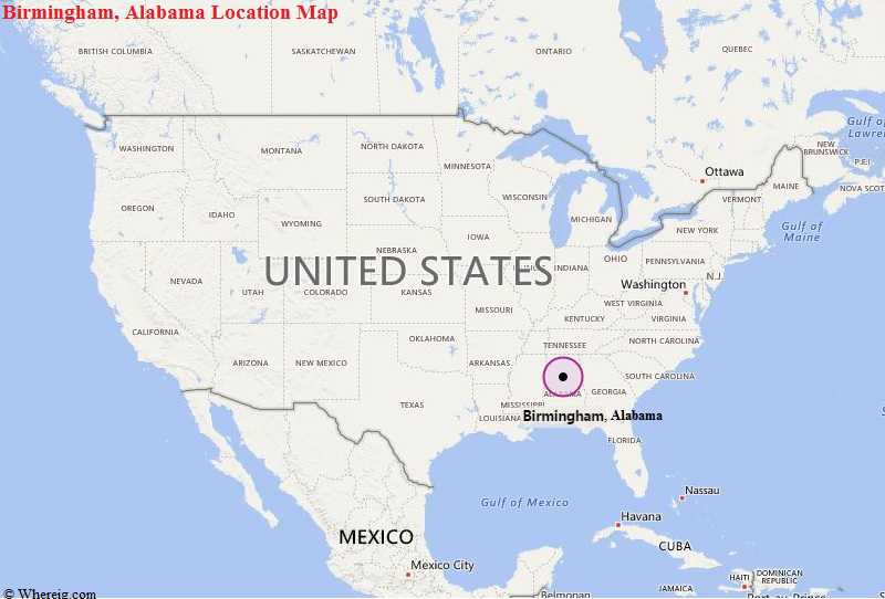
Birmingham is a city in the U.S. state of Alabama and the county seat of Jefferson County.
<
<
Birmingham, Alabama Quick Facts
| Fact | Details |
|---|---|
| City | Birmingham |
| County | Jefferson County |
| State | Alabama |
| State Capital | Montgomery |
| US Region | South |
| Latitude | 33.5186° N |
| Longitude | 86.8104° W |
| Elevation | 614 ft (187 m) |
| Land Area | 146.1 sq mi |
| Water Area | 2.3 sq mi |
| Total Area | 148.4 sq mi |
| Population (2020 Census) | 200,733 |
| Population Density | Approximately 1,374 per sq mi |
| ZIP Codes | 35201-35298 |
| Area Code | 205, 659 |
| Time Zone Standard | Central Standard Time (CST, UTC-6) |
| Time Zone Daylight | Central Daylight Time (CDT, UTC-5) |
| Currency | US Dollar (USD) |
| FIPS Code | 01-07000 |
| Congressional District | Alabama 7th Congressional District |
Location and Surroundings
Birmingham is located primarily in Jefferson County in north-central Alabama. It lies between Hoover to the south and Gardendale to the north within the Jones Valley region of the Appalachian foothills. The city is famous for its iron and steel heritage, civil rights history, healthcare sector, and role as Alabama's largest metropolitan center.
Nearby Cities to Birmingham, Alabama
- Homewood, Alabama - 4 mi South
- Mountain Brook, Alabama - 5 mi Southeast
- Vestavia Hills, Alabama - 7 mi South
- Hoover, Alabama - 10 mi Southwest
- Gardendale, Alabama - 12 mi North
- Bessemer, Alabama - 18 mi Southwest
- Trussville, Alabama - 15 mi East
- Pelham, Alabama - 20 mi South
- Alabaster, Alabama - 26 mi South
- Jasper, Alabama - 39 mi Northwest
Birmingham, Alabama Climate and Weather Overview
| Month | Avg High (°F) | Avg Low (°F) | Avg Rainfall (in) |
|---|---|---|---|
| January | 54 | 34 | 4.8 |
| April | 75 | 52 | 4.9 |
| July | 90 | 71 | 5.3 |
| October | 77 | 54 | 3.4 |
| Annual | 74 | 53 | 56.0 |
| Climate Attribute | Details |
|---|---|
| Climate Classification (Köppen) | Humid Subtropical (Cfa) |
| Annual Rainfall | About 56 inches |
| Annual Sunshine Days | Approximately 213 days |
| Hurricane/Tornado Risk | Moderate tornado risk, occasional tropical storm impacts |
| Snowfall | About 2 inches annually |
Driving Distances from Birmingham, Alabama
| City | State | Distance (mi) | Approx. Drive Time |
|---|---|---|---|
| Hoover | Alabama | 10 | 15 min |
| Bessemer | Alabama | 18 | 25 min |
| Trussville | Alabama | 15 | 20 min |
| Pelham | Alabama | 20 | 25 min |
| Tuscaloosa | Alabama | 59 | 1 hr |
| Gadsden | Alabama | 63 | 1 hr |
| Anniston | Alabama | 63 | 1 hr |
| Montgomery | Alabama | 92 | 1 hr 35 min |
| Huntsville | Alabama | 102 | 1 hr 40 min |
| Atlanta | Georgia | 147 | 2 hr 30 min |
Transportation and Connectivity in Birmingham, Alabama
| Category | Details |
|---|---|
| Airport Name | Birmingham-Shuttlesworth International Airport |
| IATA Code | BHM |
| Port | Port Birmingham |
| Major Highways | I-20, I-22, I-59, I-65, I-459, US 31, US 78, US 280 |
| Train/Amtrak Service | Amtrak Crescent |
| Local Bus/Transit Service | Birmingham Jefferson County Transit Authority (MAX Transit) |
- Interstate 20 - Major east-west route connecting Birmingham with Atlanta and Mississippi.
- Interstate 59 - Links the city with Chattanooga and New Orleans.
- Interstate 65 - Primary north-south corridor through Alabama.
- Interstate 22 - Connects Birmingham with northwestern Alabama and Memphis.
- US Route 31 - Historic north-south highway through central Alabama.
- US Route 280 - Major commuter and commercial corridor southeast of downtown.
Key Landmarks and Places to Visit in Birmingham, Alabama
| Landmark Name | Type |
|---|---|
| Vulcan Park and Museum | Monument |
| Birmingham Civil Rights Institute | Museum |
| Kelly Ingram Park | Historic Park |
| Railroad Park | Urban Park |
| McWane Science Center | Museum |
| Sloss Furnaces National Historic Landmark | Historic Site |
| Birmingham Botanical Gardens | Botanical Garden |
| Birmingham Museum of Art | Museum |
| Rickwood Field | Historic Sports Venue |
| Red Mountain Park | Nature Park |
Waterbodies in Birmingham, Alabama
Black Warrior River, Cahaba River, Village Creek, Five Mile Creek, Shades Creek, Turkey Creek, Lake Purdy, Blackburn Fork, Locust Fork, East Lake
Golf Courses in Birmingham, Alabama
Highland Park Golf Course, Ballantrae Golf Club, Bent Brook Golf Course, Ross Bridge Golf Resort, Oxmoor Valley Golf Course, Highlands Golf Course, Greystone Golf and Country Club, Timberline Golf Club, Pine Tree Country Club, Limestone Springs Golf Club
Economy and Major Employers in Birmingham, Alabama
| Sector | Major Employer or Industry | Notes |
|---|---|---|
| Healthcare | UAB Health System | Largest employer in the metropolitan area. |
| Education | University of Alabama at Birmingham | Major research institution. |
| Finance | Regions Financial Corporation | Corporate headquarters located downtown. |
| Banking | Protective Life Corporation | Leading insurance and financial services company. |
| Manufacturing | Steel and Metals Industry | Historic foundation of the local economy. |
| Healthcare | Children's of Alabama | Major pediatric healthcare provider. |
| Technology | Technology and Innovation Firms | Growing business sector. |
| Logistics | Transportation and Distribution | Benefits from the city's central location. |
Colleges and Schools in Birmingham, Alabama
| Institution Name | Type | Level | Notable For |
|---|---|---|---|
| University of Alabama at Birmingham | Public | University | Medical research |
| Samford University | Private | University | Liberal arts and law |
| Miles College | Private | University | Historically Black college |
| Birmingham-Southern College | Private | University | Historic liberal arts institution |
| Jefferson State Community College | Public | Community College | Workforce education |
| Birmingham City Schools | Public | K-12 District | Largest district in the city |
Birmingham, Alabama - Key Historical Facts
- Birmingham was founded in 1871 at the crossing of two major railroad lines shortly after the American Civil War.
- The city grew rapidly because rich deposits of iron ore, coal, and limestone were located nearby.
- Birmingham became one of the leading steel-producing centers in the southern United States during the late nineteenth century.
- The city played a pivotal role in the American Civil Rights Movement during the 1950s and 1960s.
- Events in Birmingham helped lead to the passage of the Civil Rights Act of 1964.
- Today, Birmingham is recognized as a major center for healthcare, education, finance, and business in Alabama.
Sources
- Official City of Birmingham Website
- Official Jefferson County Website
- U.S. Census Bureau
- U.S. Geological Survey (USGS)
- National Weather Service
Alabama Links
US Cities Location
- Where is Akron
- Where is Anaheim
- Where is Anchorage
- Where is Arlington
- Where is Aurora
- Where is Baltimore
- Where is Baton Rouge
- Where is Birmingham
- Where is Boise City
- Where is Boston
- Where is Buffalo
- Where is Chandler
- Where is Charlotte
- Where is Chesapeake
- Where is Chula Vista
- Where is Cincinnati
- Where is Cleveland
- Where is Colorado Springs
- Where is Columbus
- Where is Corpus Christi
- Where is Des Moines
- Where is Detroit
- Where is Durham
- Where is El Paso
- Where is Fayetteville
- Where is Fort Wayne
- Where is Freemont
- Where is Fresno
- Where is Garland
- Where is Gilbert
- Where is Glendale
- Where is Greensboro
- Where is Henderson
- Where is Hialeah
- Where is Honolulu
- Where is Houston
- Where is Indianapolis
- Where is Irvine
- Where is Irving
- Where is Jacksonville
- Where is Jersey City
- Where is Kansas City
- Where is Laredo
- Where is Lincoln
- Where is Long Beach
- Where is Louisville
- Where is Lubbock
- Where is Madison
- Where is Memphis
- Where is Mesa
- Where is Milwaukee
- Where is Minneapolis
- Where is Modesto
- Where is Montgomery
- Where is Nashville
- Where is Newark
- Where is Norfolk
- North Las Vegas
- Oakland
- Oklahoma City
- Where is Omaha
- Where is Orlando
- Where is Paradise
- Where is Philadelphia
- Where is Phoenix
- Where is Portland
- Where is Raleigh
- Where is Reno
- Where is Richmond
- Where is Riverside
- Where is Rochester
- Where is Sacramento
- Where is Saint Paul
- Where is Saint Petersburg
- Where is San Bernardino
- Where is San Jose
- Where is Santa Ana
- Where is Scottsdale
- Where is Shreveport
- Where is Spokane
- Where is St Louis
- Where is Stockton
- Where is Tampa
- Where is Toledo
- Where is Tucson
- Where is Tulsa
- Where is Virginia Beach
- Where is Wichita