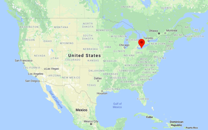
Cleveland is located in the north-east of the Ohio. It is the second largest city in the state of Ohio.
Cleveland City Location Map

Where is Cleveland City Located?
Cleveland is located along the southern shore of Lake Erie, across the U.S. maritime border with Canada and approximately 60 miles (100 kilometers) west of the Ohio. It is a major city in the U.S. state of Ohio, and the county seat of Cuyahoga County. With an estimate population of 381,009 in 2019 data. It covers and area of 82.48 sq mi (213.62 sq km).
Ohio More Maps & Info
Cleveland City Facts
| Sr. No | Fact sheet | Cleveland |
|---|---|---|
| 1 | Country | USA |
| 2 | State | Ohio |
| 3 | Location | North-East |
| 4 | Latitude | 41.28′56″N |
| 5 | Longitude | 81.40′11″W |
| 6 | Total area | 213.60km2 ( 82.45 sq mi ) |
| 7 | Total Population | 393,806 |
| 8 | Zip Codes | 44101 |
| 9 | Area code | 216 |
| 10 | Nearby Cities | Brooklyn, Cleveland Heights, Lakewood, Garfield Heights |
| 11 | Major Tourists' Attraction | Great Lakes Science Center, The Cleveland Orchestra, Tower City Center, Cleveland Zoo |
| 12 | Nearest airport | Cleveland Hopkins International Airport (about 14 miles) |
- Where is Akron
- Where is Anaheim
- Where is Anchorage
- Where is Arlington
- Where is Aurora
- Where is Baltimore
- Where is Baton Rouge
- Where is Birmingham
- Where is Boise City
- Where is Boston
- Where is Buffalo
- Where is Chandler
- Where is Charlotte
- Where is Chesapeake
- Where is Chula Vista
- Where is Cincinnati
- Where is Cleveland
- Where is Colorado Springs
- Where is Columbus
- Where is Corpus Christi
- Where is Des Moines
- Where is Detroit
- Where is Durham
- Where is El Paso
- Where is Fayetteville
- Where is Fort Wayne
- Where is Freemont
- Where is Fresno
- Where is Garland
- Where is Gilbert
- Where is Glendale
- Where is Greensboro
- Where is Henderson
- Where is Hialeah
- Where is Honolulu
- Where is Houston
- Where is Indianapolis
- Where is Irvine
- Where is Irving
- Where is Jacksonville
- Where is Jersey City
- Where is Kansas City
- Where is Laredo
- Where is Lincoln
- Where is Long Beach
- Where is Louisville
- Where is Lubbock
- Where is Madison
- Where is Memphis
- Where is Mesa
- Where is Milwaukee
- Where is Minneapolis
- Where is Modesto
- Where is Montgomery
- Where is Nashville
- Where is Newark
- Where is Norfolk
- Where is North Las Vegas
- Where is Oakland
- Where is Oklahoma City
- Where is Omaha
- Where is Orlando
- Where is Paradise
- Where is Philadelphia
- Where is Phoenix
- Where is Portland
- Where is Raleigh
- Where is Reno
- Where is Richmond
- Where is Riverside
- Where is Rochester
- Where is Sacramento
- Where is Saint Paul
- Where is Saint Petersburg
- Where is San Bernardino
- Where is San Jose
- Where is Santa Ana
- Where is Scottsdale
- Where is Shreveport
- Where is Spokane
- Where is St Louis
- Where is Stockton
- Where is Tampa
- Where is Toledo
- Where is Tucson
- Where is Tulsa
- Where is Virginia Beach
- Where is Wichita
Written and fact-checked by Whereig.com Web Team | Last Updated: January 11, 2025, 11:50 PM ET
