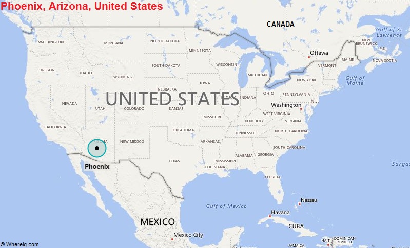
Phoenix is a city in Arizona. Phoenix is in the southwestern United States, in the south-central portion of Arizona, about halfway between Tucson to the southeast and Flagstaff to the north.
Location Map of Phoenix, Arizona

Where is Phoenix Located, TX?
Phoenix is the capital and most populous city in Arizona and the 5th most populous city in the United States, it is the seat of Maricopa County. It comprising a total area of 519.11 sq mi (1,344.50 sq km), with an estimated population of 1,680,992 in 2019.
Phoenix City Facts
| Continent | North America |
| Country | USA |
| State | Arizona |
| County | Maricopa |
| Coordinates: | 33°26′54″N 112°04′26″W |
| Location | Central part of the State |
| Latitude | 33º27’N |
| Longitude | 112º04’N |
| Settled | 1867 |
| Incorporated | February 25, 1881 |
| Area | 519.11 sq mi (1,344.50 sq km) |
| Total Population (2019) | 1,680,992 (5th Rank in US) |
| Population Dencity | 3,246.02/sq mi (1,253.29/km2) |
| Zip Codes Code | 85001–85099 |
| Area Code | 602 (Central), 480 (East), 623 (West), 520 |
| Nearby Cities | Gilbert, Tucson, Las Vegas, San Diego |
| Major Tourists' Attraction | Desert Botanical Gardens, Heard Museum, Canyon Creek Ranch, Mystery Castle |
| Airport | Phoenix Sky Harbor International Airport, Deer Valley Airport, Phoenix–Mesa Gateway Airport |
| Interstates | I-10, I-17 |
| State Routes | 51, 74, 101, 143, 202, 203 |
| US highways | 60 |
| Metro Rail Transit | Valley Metro |
| Climate | Hot desert climate |
| Government Type | Council-Manager |
| Govt Body | Phoenix City Council |
| Website | www.phoenix.gov/ |
- Where is Akron
- Where is Anaheim
- Where is Anchorage
- Where is Arlington
- Where is Aurora
- Where is Baltimore
- Where is Baton Rouge
- Where is Birmingham
- Where is Boise City
- Where is Boston
- Where is Buffalo
- Where is Chandler
- Where is Charlotte
- Where is Chesapeake
- Where is Chula Vista
- Where is Cincinnati
- Where is Cleveland
- Where is Colorado Springs
- Where is Columbus
- Where is Corpus Christi
- Where is Des Moines
- Where is Detroit
- Where is Durham
- Where is El Paso
- Where is Fayetteville
- Where is Fort Wayne
- Where is Freemont
- Where is Fresno
- Where is Garland
- Where is Gilbert
- Where is Glendale
- Where is Greensboro
- Where is Henderson
- Where is Hialeah
- Where is Honolulu
- Where is Houston
- Where is Indianapolis
- Where is Irvine
- Where is Irving
- Where is Jacksonville
- Where is Jersey City
- Where is Kansas City
- Where is Laredo
- Where is Lincoln
- Where is Long Beach
- Where is Louisville
- Where is Lubbock
- Where is Madison
- Where is Memphis
- Where is Mesa
- Where is Milwaukee
- Where is Minneapolis
- Where is Modesto
- Where is Montgomery
- Where is Nashville
- Where is Newark
- Where is Norfolk
- Where is North Las Vegas
- Where is Oakland
- Where is Oklahoma City
- Where is Omaha
- Where is Orlando
- Where is Paradise
- Where is Philadelphia
- Where is Phoenix
- Where is Portland
- Where is Raleigh
- Where is Reno
- Where is Richmond
- Where is Riverside
- Where is Rochester
- Where is Sacramento
- Where is Saint Paul
- Where is Saint Petersburg
- Where is San Bernardino
- Where is San Jose
- Where is Santa Ana
- Where is Scottsdale
- Where is Shreveport
- Where is Spokane
- Where is St Louis
- Where is Stockton
- Where is Tampa
- Where is Toledo
- Where is Tucson
- Where is Tulsa
- Where is Virginia Beach
- Where is Wichita
Written and fact-checked by Whereig.com Web Team | Last Updated: January 11, 2025, 11:50 PM ET
