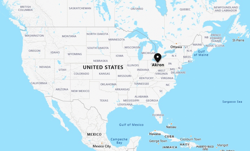
Akron is located in the north-east of the state. It is the fifth largest city of the state Ohio.
Akron City Location Map

About Akron City
Akron is the fifth-largest city in the U.S. state of Ohio and is the county seat of Summit County. With an estimate population of 197,597 in 2019 data. Akron is located in the Great Lakes region about 39 miles (63 km) south of Lake Erie, on the Glaciated Allegheny Plateau. It covers and area of 62.27 sq mi (161.29 sq km).
Ohio More Maps & Info
Akron City Facts
| Sr. No | Fact sheet | Akron |
|---|---|---|
| 1 | Country | USA |
| 2 | State | Ohio |
| 3 | Location | North- East |
| 4 | Latitude | 41.4′23″N |
| 5 | Longitude | 81.31′4″W |
| 6 | Total area | 161.53km2 ( 62.36 sq mi ) |
| 7 | Total Population | 198,402 |
| 8 | Zip | 44301 |
| 9 | Area code | 330, 234 |
| 10 | Nearby Cities | Tallmadge, Barberton, Norton, Kent |
| 11 | Major Tourists' Attraction | Stan Hywet Hall and Gardens, Firestone Country Club, John S. Knight Center, Quaker Square |
| 12 | Nearest airport | Akron-Canton Regional Airport (about 15 miles) |
- Where is Akron
- Where is Anaheim
- Where is Anchorage
- Where is Arlington
- Where is Aurora
- Where is Baltimore
- Where is Baton Rouge
- Where is Birmingham
- Where is Boise City
- Where is Boston
- Where is Buffalo
- Where is Chandler
- Where is Charlotte
- Where is Chesapeake
- Where is Chula Vista
- Where is Cincinnati
- Where is Cleveland
- Where is Colorado Springs
- Where is Columbus
- Where is Corpus Christi
- Where is Des Moines
- Where is Detroit
- Where is Durham
- Where is El Paso
- Where is Fayetteville
- Where is Fort Wayne
- Where is Freemont
- Where is Fresno
- Where is Garland
- Where is Gilbert
- Where is Glendale
- Where is Greensboro
- Where is Henderson
- Where is Hialeah
- Where is Honolulu
- Where is Houston
- Where is Indianapolis
- Where is Irvine
- Where is Irving
- Where is Jacksonville
- Where is Jersey City
- Where is Kansas City
- Where is Laredo
- Where is Lincoln
- Where is Long Beach
- Where is Louisville
- Where is Lubbock
- Where is Madison
- Where is Memphis
- Where is Mesa
- Where is Milwaukee
- Where is Minneapolis
- Where is Modesto
- Where is Montgomery
- Where is Nashville
- Where is Newark
- Where is Norfolk
- Where is North Las Vegas
- Where is Oakland
- Where is Oklahoma City
- Where is Omaha
- Where is Orlando
- Where is Paradise
- Where is Philadelphia
- Where is Phoenix
- Where is Portland
- Where is Raleigh
- Where is Reno
- Where is Richmond
- Where is Riverside
- Where is Rochester
- Where is Sacramento
- Where is Saint Paul
- Where is Saint Petersburg
- Where is San Bernardino
- Where is San Jose
- Where is Santa Ana
- Where is Scottsdale
- Where is Shreveport
- Where is Spokane
- Where is St Louis
- Where is Stockton
- Where is Tampa
- Where is Toledo
- Where is Tucson
- Where is Tulsa
- Where is Virginia Beach
- Where is Wichita
Written and fact-checked by Whereig.com Web Team | Last Updated: January 11, 2025, 11:50 PM ET
