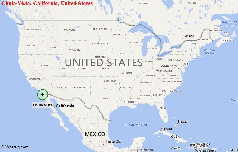
Chula Vista is located in the southern part of the state. It is the fourteenth largest city in the State of California, and the seventy seventh largest city in the U.S.
| Sr. No | Fact sheet | Chula Vista |
|---|---|---|
| 1 | Country | USA |
| 2 | State | California |
| 3 | Location | Southern part of the State |
| 4 | Latitude | 32.37′40″N |
| 5 | Longitude | 117.2′53″W |
| 6 | Total area | 134.90km2 ( 52.090 sq mi ) |
| 7 | Total Population | 247,535 |
| 8 | Zip Codes | 91909 |
| 9 | Area code | 619 |
| 10 | Nearby Cities | National City, Bonita, Imperial Beach, San Diego |
| 11 | Major Tourists' Attraction | Cricket Wireless Amphitheatre, Knotts Soak City USA, U.S. Olympic Training Center, Len Moore Skate Park |
| 12 | Nearest airport | San Diego International Airport (about 11 miles), General Abelardo L. Rodr�guez International Airport (14 miles) |
Most Viewed CA Maps
Location Map of California Cities
- Where is Berkeley
- Where is Clovis
- Where is Corona
- Where is Elk Grove
- Where is Escondido
- Where is Fontana
- Where is Fremont
- Where is Fullerton
- Where is Garden Grove
- Where is Hayward
- Where is Huntington Beach
- Where is Lancaster
- Where is Moreno Valley
- Where is Oceanside
- Where is Ontario
- Where is Orange
- Where is Oxnard
- Where is Palmdale
- Where is Pasadena
- Where is Pomona
- Where is Rancho Cucamonga
- Where is Roseville
- Where is Salinas
- Where is Santa Clara
- Where is Santa Clarita
- Where is Santa Rosa
- Where is Sunnyvale
- Where is Thousand Oaks
- Where is Torrance
- Where is Vallejo
- Where is Victorville
- Where is Visalia


