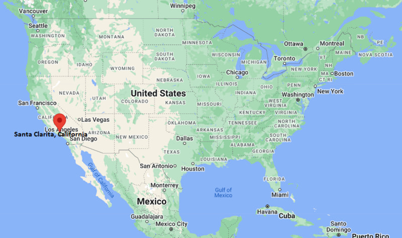
Where is Santa Clarita Located? - Santa Clarita is a city located in the Los Angeles County of California, United States. Santa Clarita lies between 39.0639 Degrees North latitudes and 108.5506 Degrees West longitudes.
Location Map of Santa Clarita, California

Santa Clarita Map, California, USA
Where is Santa Clarita?: The Google Map showing the location of Santa Clarita in the U.S. state of California.
Where is Santa Clarita Located?
Santa Clarita is a city located in the Los Angeles County of California, United States. Santa Clarita lies between 39.0639 Degrees North latitudes and 108.5506 Degrees West longitudes. According to 2020 U.S.census, the population of Santa Clarita city is 228673 people and the city has a total area of 70.75 sq mi. The city has numerous parks and recreational facilities.
Most Viewed US Maps
Santa Clarita City Facts, California
| City Name | Santa Clarita |
| County | Los Angeles County |
| State | California |
| Country | United States |
| U.S. Region | Pacific |
| Coordinates | 34.3917° N, 118.5426° W |
| Latitude | 34.3916641 |
| Longitude | -118.542586 |
| Population (2020 Census) | 228673 |
| Population Density (Sq mi) | 3454 |
| Area (Sq mi) | 70.75 |
| Currency | US Dollar, $ (USD) |
| Time Zone | Pacific Time - UTC?08:00 (Standard), UTC?07:00 (DST) |
California Related Links
- Where is Berkeley
- Where is Clovis
- Where is Corona
- Where is Elk Grove
- Where is Escondido
- Where is Fontana
- Where is Fremont
- Where is Fullerton
- Where is Garden Grove
- Where is Hayward
- Where is Huntington Beach
- Where is Lancaster
- Where is Moreno Valley
- Where is Oceanside
- Where is Ontario
- Where is Orange
- Where is Oxnard
- Where is Palmdale
- Where is Pasadena
- Where is Pomona
- Where is Rancho Cucamonga
- Where is Roseville
- Where is Salinas
- Where is Santa Clara
- Where is Santa Clarita
- Where is Santa Rosa
- Where is Sunnyvale
- Where is Thousand Oaks
- Where is Torrance
- Where is Vallejo
- Where is Victorville
- Where is Visalia
