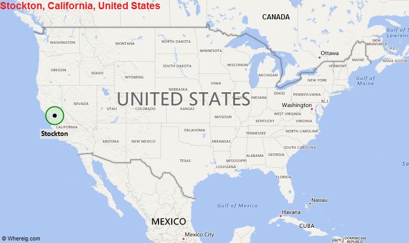
Stockton is the county seat of San Joaquin County in the Central Valley of the U.S. state of California It is the 13th largest city by population in the state of California.
| Sr. No | Fact sheet | Stockton |
|---|---|---|
| 1 | Country | USA |
| 2 | State | California |
| 3 | Location | Central part of the State |
| 4 | Latitude | 37.58′32″N |
| 5 | Longitude | 121.18′03″W |
| 6 | Total area | 167.705km2 ( 64.750 sq mi ) |
| 7 | Total Population | 296,357 |
| 8 | Zip Codes | 95201 |
| 9 | Area code | 209 |
| 10 | Nearby Cities | Country Club, Garden Acres, Lodi, Lathrop |
| 11 | Major Tourists' Attraction | Haggin Museum, Stockton Arena, Downtown Stockton Marina and Joan Darrah Promenade, Little Manila |
| 12 | Nearest airport | Stockton Metropolitan Airport (about 8 miles) |
Most Viewed CA Maps
Location Map of California Cities
- Where is Berkeley
- Where is Clovis
- Where is Corona
- Where is Elk Grove
- Where is Escondido
- Where is Fontana
- Where is Fremont
- Where is Fullerton
- Where is Garden Grove
- Where is Hayward
- Where is Huntington Beach
- Where is Lancaster
- Where is Moreno Valley
- Where is Oceanside
- Where is Ontario
- Where is Orange
- Where is Oxnard
- Where is Palmdale
- Where is Pasadena
- Where is Pomona
- Where is Rancho Cucamonga
- Where is Roseville
- Where is Salinas
- Where is Santa Clara
- Where is Santa Clarita
- Where is Santa Rosa
- Where is Sunnyvale
- Where is Thousand Oaks
- Where is Torrance
- Where is Vallejo
- Where is Victorville
- Where is Visalia


