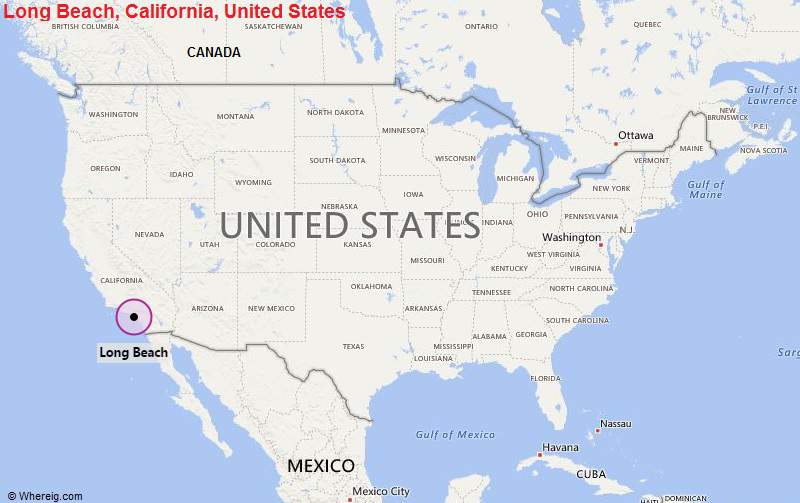
Long Beach is located in the southern part of the state. It is the seventh-largest city in the state of California, and the 36th-largest in the United States.
| Sr. No | Fact sheet | Long Beach |
|---|---|---|
| 1 | Country | USA |
| 2 | State | California |
| 3 | Location | Southern part of the State |
| 4 | Latitude | 33.46′5.9556″N |
| 5 | Longitude | 118.11′44.2206″W |
| 6 | Total area | 133.220km2 ( 51.430 sq mi ) |
| 7 | Total Population | 465,576 |
| 8 | Zip Codes | 90801 |
| 9 | Area code | 562 |
| 10 | Nearby Cities | Signal Hill, West Carson, Bellflower, Compton |
| 11 | Major Tourists' Attraction | Long Beach Waterfront, Catalina Express, Earl Burns Miller Japanese Garden, Long Beach Museum of Art |
| 12 | Nearest airport | Long Beach Airport (about 5 miles), John Wayne Airport (22 miles), Los Angeles International Airport (23 miles) |
Most Viewed CA Maps
Location Map of California Cities
- Where is Berkeley
- Where is Clovis
- Where is Corona
- Where is Elk Grove
- Where is Escondido
- Where is Fontana
- Where is Fremont
- Where is Fullerton
- Where is Garden Grove
- Where is Hayward
- Where is Huntington Beach
- Where is Lancaster
- Where is Moreno Valley
- Where is Oceanside
- Where is Ontario
- Where is Orange
- Where is Oxnard
- Where is Palmdale
- Where is Pasadena
- Where is Pomona
- Where is Rancho Cucamonga
- Where is Roseville
- Where is Salinas
- Where is Santa Clara
- Where is Santa Clarita
- Where is Santa Rosa
- Where is Sunnyvale
- Where is Thousand Oaks
- Where is Torrance
- Where is Vallejo
- Where is Victorville
- Where is Visalia


