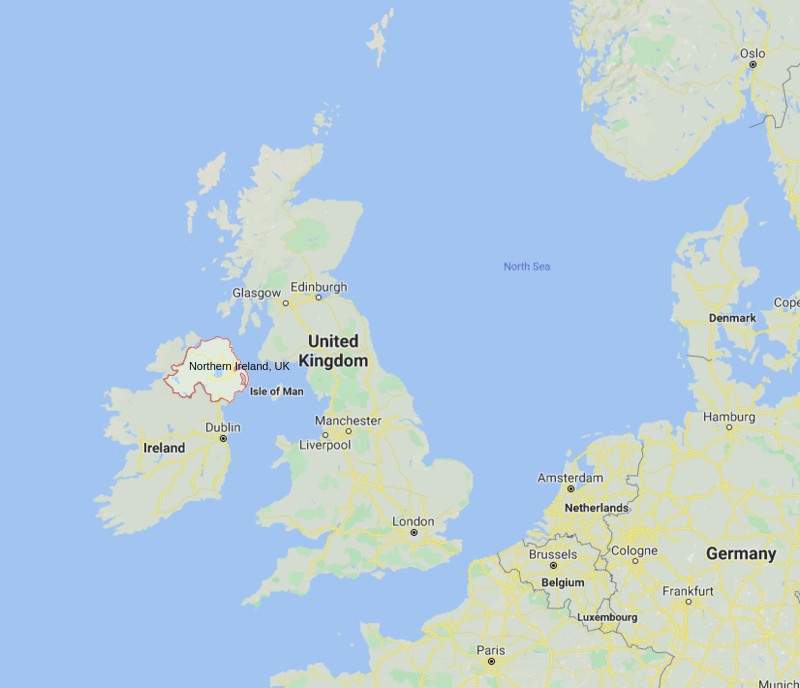
Where is Northern Ireland Located?
Northern Ireland is located in the northeast of the island of Ireland, It shares a border to the south and west with the Republic of Ireland.
Northern Ireland Facts
| FACTS | Info |
|---|---|
| Sovereign State | United Kingdom |
| Continent | Europe |
| Sovereign state | United Kingdom |
| Capital and largest city | "Belfast |
| Northern Ireland Official Language | English |
| Regional languages | "Irish Ulster-Scots" |
| Area of Northern Ireland | 14,130 km2 (5,460 sq mi) |
| Ceremonial county | Antrim, Armagh, Down, Fermanagh, Londonderry and Tyrone |
| Location | Northeast of the island of Ireland |
| Coordinates | 54.7877° N, 6.4923° W |
| Population | 1,903,100 |
| Population Density | 135/km2 |
| Currency | Pound sterling (GBP) |
| Time zone | GMT (UTC 0) and BST (UTC+1) in summer |
| Country code | 44 |
| Postcode areas | BT |
| Postcode | BT41 |
| Dialling codes | 44 |
| Climate | Temperate climate |
| Airport | Belfast Airport |


