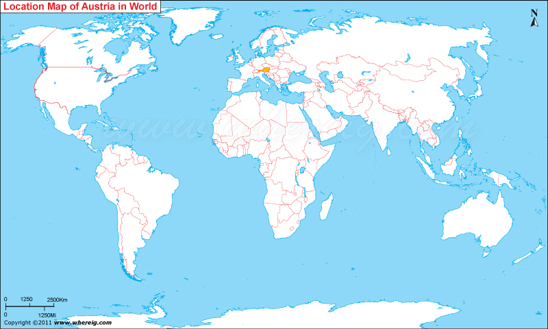
Austria is located in the central Europe in the world map.
Austria , is a landlocked country and is bordered by Germany and the Czech Republic to the north, Slovakia and Hungary to the east, Slovenia and Italy to the south, and Switzerland and Liechtenstein to the west. The Austria has a temperate and alpine climate. Austria's terrain is highly mountainous due to the presence of the Alps; only 32% of the country is below 500 metres (1,640 ft), and its highest point is 3,797 metres (12,457 ft). It is mainly a mountainous country Austria comprises of nine federal states. The capital and largest city of Austria is Vienna. There are 220 cities all total. Austria is an amazing travel destination, full of history, beautiful landscapes, cultural riches and equipped with a fine hospitality this little country in the heart of Europe attracts some millions of visitors from all over the world each year.
Major tourist attractions are:-
Schloss Schönbrunn
Fortress Hohensalzburg
Grossglockner High Alpine Road
Basilica Mariazell
Great Ferris wheel Prater, Vienna
Schlossberg Graz
Swarovski Crystal Worlds
Museum of Fine Arts
Belvedere
Grossglockner High
Major tourist attractions are:-
Schloss Schönbrunn
Fortress Hohensalzburg
Grossglockner High Alpine Road
Basilica Mariazell
Great Ferris wheel Prater, Vienna
Schlossberg Graz
Swarovski Crystal Worlds
Museum of Fine Arts
Belvedere
Grossglockner High
| Country | Austria |
| Continent | Europe |
| Where is Located | Austria is a country located in the Western Europe |
| Coordinates | 48.2, 16.35 |
| Capital | Vienna |
| Largest City | Vienna |
| Neighboring Countries | Czech Republic, Germany, Hungary, Italy, Liechtenstein, Slovakia, Slovenia, Switzerland |
| Administrative divisions | 9 states |
| Area | 83,871 Sq km |
| Population | 8414638 |
| Official Language | German |
| Currency | Euro (EUR) |
| ISO Alpha-2 Code | AT |
| ISO Alpha-3 Code | AUT |
| ISO Numeric Code | 40 |
| GDP | $398.594 billion |
| Calling code | 43 |
| Time Zone | CET (UTC+01) |
| Internet TLD | .at |
European Countries Location Maps
- Where is Albania
- Where is Andorra
- Where is Austria
- Where is Belarus
- Where is Belgium
- Bosnia and Herzegovina
- Where is Bulgaria
- Where is Croatia
- Where is Cyprus
- Where is Czech Republic
- Where is Denmark
- Where is England
- Where is Estonia
- Where is Finland
- Where is France
- Where is Germany


