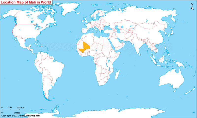
Where is Mali located on the world map? The given Mali location map shows that Mali located in the western part of Africa continent.
Mali map also shows that Mali is a landlocked country that shares its international boundaries with Algeria in the north, Nigeria in the east, Burkina Faso and Cote d'Ivoire in the south, Senegal and Mauritania in the west, and Guinea on the south-west.
In the year 1991, Mali people have drafted a new constitution for themselves that facilitates the country as democratic government featured with multi-party system. President, who is elected for a five-year term by universal suffrage and is limited to two terms, enjoys the executive power.
The economy of the country is largely depends upon the agriculture and fishing. However, some of the natural resources that contribute in the country's economy are gold, uranium, and salt.
Facts About Mali
| Country | Mali |
|---|---|
| Continent | Africa |
| Where is Located | Mali is a country located in the West Africa |
| Coordinates | 14.8128° N, 5.5030° W |
| Capital | Bamako |
| Largest City | Bamako |
| Neighboring Countries | Algeria, Burkina Faso, Guinea, Côte d'Ivoire, Mauritania, Niger, Senegal |
| Administrative divisions | 8 regions |
| Area | 478,800 sq miles (1,240,000 sq km) |
| Population | 15,494,466 (July 2012 est.) |
| Official Language | French, Bambara, Peul/foulfoulbe |
| Major Religion | Christian ,Islam, Tengriism and Buddhism |
| Ethic Group | 50% Mande 17% Fula 12% Voltaic (Senufo / Bwa) 10% Tuareg / Moor 6% Songhai 4% other |
| Currency | West African CFA franc (XOF) |
| ISO Alpha-2 Code | ML |
| ISO Alpha-3 Code | MLI |
| ISO & UN M49 Numeric Code | 466 |
| GDP | $17.983 billion 2012 estimate |
| National day | Independence Day, 22 September (1960) |
| Form of Government | Unitary semi-presidential republic |
| President | Ibrahim Boubacar Keita |
| Vice President | |
| Prime Minister | Moussa Mara |
| Calling code | 223 |
| Time Zone | GMT (UTC+0) |
| Internet TLD | .ml |
- Where is Algeria
- Where is Angola
- Where is Benin
- Where is Botswana
- Where is Burkina Faso
- Where is Burundi
- Where is Cameroon
- Where is Canary Islands
- Where is Cape Verde
- Central African Republic
- Where is Ceuta
- Where is Chad
- Where is Cote d'Ivoire
- Where is Congo
- Where is Djibouti
- Where is Egypt
- Equatorial Guinea
- Where is Eritrea
- Where is Ethiopia
- Where is Gabon
- Where is Gambia
- Where is Ghana
- Where is Guinea
- Guinea Bissau
- Where is Kenya
- Where is Lesotho
- Where is Liberia
- Where is Libya
- Where is Madagascar
- Where is Madeira
- Where is Malawi
- Where is Mali
- Where is Mauritania
- Where is Mauritius
- Where is Mayotte
- Where is Morocco
- Where is Mozambique
- Where is Namibia
- Where is Niger
- Where is Nigeria
- Where is Congo
- Where is Reunion
- Where is Rwanda
- Where is Saint Helena
- Where is Sao Tome
- Where is Senegal
- Where is Seychelles
- Where is Sierra Leone
- Where is South Africa
- Where is Sudan
- Where is Swaziland
- Where is Tanzania
- Where is Togo
- Where is Tunisia
- Where is Uganda
- Where is Western Sahara
- Where is Zambia
- Where is Zimbabwe


