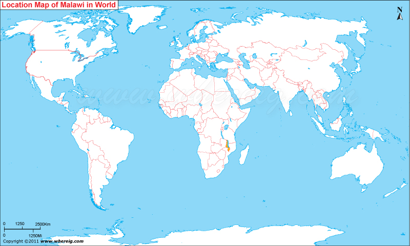
Where is Malawi located on the world map? The given Malawi location map shows that Malawi is located in the south-east of Africa continent.
Malawi map also shows that Malawi is a landlocked country that shares its international boundaries with Zambia in the north-west, Tanzania in the north-east, and Mozambique in the east, south and west. Besides, the big lake i.e. Lake Malawi separates Malawi from Mozambique and Tanzania. The Lake Malawi is great tourist centre in Malawi.
The government type of Malawi is a democratic featured with multi-party system. The former name of Malawi was Nyasaland. However, the new name Malawi is derived from the Maravi, an old name of the Nyanja people who inhabit the area. Interestingly, the country has also a sobriquet i.e. "The Warm Heart of Africa.” The capital city of the country is Lilongwe.
Country’s economy is largely depends upon agriculture. Major chunk of people live in the rural area and practice agriculture. The climate type of Malawi is hot in the low-lying areas i.e. in the south of the country and temperate in the highlands areas i.e. in the northern region of the country.
| Country | Malawi |
| Continent | Africa |
| Where is Located | |
| Coordinates | 13°57'S33°42'E |
| Capital | Lilongwe |
| Largest City | Lilongwe |
| Neighboring Countries | Mozambique, Tanzania, Zambia |
| Administrative divisions | 28 districts |
| Area | 45,747 Sq Mi (118,484 Sq km) |
| Population | 14,901,000 (2010 Est.) |
| Official Language | English, Chichewa |
| Currency | Kwacha (D) (MWK) |
| ISO Alpha-2 Code | MW |
| ISO Alpha-3 Code | MWI |
| ISO Numeric Code | 454 |
| GDP | $14.265 billion 2012 estimate |
| Calling code | 265 |
| Time Zone | CAT (UTC+2) |
| Internet TLD | .mw |
- Where is Algeria
- Where is Angola
- Where is Benin
- Where is Botswana
- Where is Burkina Faso
- Where is Burundi
- Where is Cameroon
- Where is Canary Islands
- Where is Cape Verde
- Central African Republic
- Where is Ceuta
- Where is Chad
- Where is Cote d'Ivoire
- Where is Congo
- Where is Djibouti
- Where is Egypt
- Equatorial Guinea
- Where is Eritrea
- Where is Ethiopia
- Where is Gabon
- Where is Gambia
- Where is Ghana
- Where is Guinea
- Guinea Bissau
- Where is Kenya
- Where is Lesotho
- Where is Liberia
- Where is Libya
- Where is Madagascar
- Where is Madeira
- Where is Malawi
- Where is Mali
- Where is Mauritania
- Where is Mauritius
- Where is Mayotte
- Where is Morocco
- Where is Mozambique
- Where is Namibia
- Where is Niger
- Where is Nigeria
- Where is Congo
- Where is Reunion
- Where is Rwanda
- Where is Saint Helena
- Where is Sao Tome
- Where is Senegal
- Where is Seychelles
- Where is Sierra Leone
- Where is South Africa
- Where is Sudan
- Where is Swaziland
- Where is Tanzania
- Where is Togo
- Where is Tunisia
- Where is Uganda
- Where is Western Sahara
- Where is Zambia
- Where is Zimbabwe


