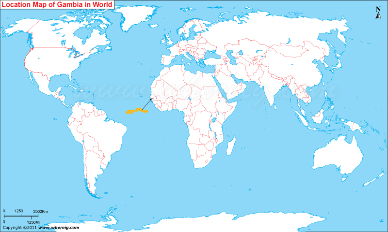
Where is Gambia Located?
The given location map of Gambia shows that Gambia is located in the western part of Africa continent.
Gambia got its independence in the year 1965 from UK and then joined The Commonwealth. The country has adopted democracy with multi-party features where election used to held after every five years.
The economy of the country is largely depends upon farming, fishing, and tourism.
| Country | The Gambia |
| Continent | Africa |
| Where is Located | Gambia is a country located in the West Africa |
| Coordinates | 13.28 N, 16.34 W |
| Capital | Banjul |
| Largest City | Serekunda |
| Neighboring Countries | Senegal |
| Administrative divisions | 5 divisions and 1 city |
| Area | 11,295 sq km |
| Population | 1,782,893 (2009 estimate) |
| Official Language | English |
| Currency | Dalasi (GMD) |
| ISO Alpha-2 Code | GM |
| ISO Alpha-3 Code | GMB |
| ISO Numeric Code | 270 |
| GDP | $3.403 billion 2012 estimate |
| Calling code | 220 |
| Time Zone | GMT |
| Internet TLD | .gm |
- Where is Algeria
- Where is Angola
- Where is Benin
- Where is Botswana
- Where is Burkina Faso
- Where is Burundi
- Where is Cameroon
- Where is Canary Islands
- Where is Cape Verde
- Central African Republic
- Where is Ceuta
- Where is Chad
- Where is Cote d'Ivoire
- Where is Congo
- Where is Djibouti
- Where is Egypt
- Equatorial Guinea
- Where is Eritrea
- Where is Ethiopia
- Where is Gabon
- Where is Gambia
- Where is Ghana
- Where is Guinea
- Guinea Bissau
- Where is Kenya
- Where is Lesotho
- Where is Liberia
- Where is Libya
- Where is Madagascar
- Where is Madeira
- Where is Malawi
- Where is Mali
- Where is Mauritania
- Where is Mauritius
- Where is Mayotte
- Where is Morocco
- Where is Mozambique
- Where is Namibia
- Where is Niger
- Where is Nigeria
- Where is Congo
- Where is Reunion
- Where is Rwanda
- Where is Saint Helena
- Where is Sao Tome
- Where is Senegal
- Where is Seychelles
- Where is Sierra Leone
- Where is South Africa
- Where is Sudan
- Where is Swaziland
- Where is Tanzania
- Where is Togo
- Where is Tunisia
- Where is Uganda
- Where is Western Sahara
- Where is Zambia
- Where is Zimbabwe


