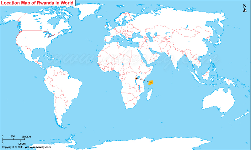
Rwanda is located in the central-estern part of Africa continent. Rwanda map also shows that Rwanda is landlocked country that shares its international boundaries with the Democratic Republic of the Congo in the west, Burundi in the south, Tanzania in the east, and Uganda in the north.
Though, Rwanda is landlocked country, but there are several lakes surrounding it. The climate type of the country is temperate featured with two rainy seasons and two dry seasons in the year.
The capital city is Kigali; it is also populated center along with the administrative center. The government type of Rwanda is presidential system under which the President has extensive powers; whereas the Parliament makes legislation and has limited oversight.
Rwanda’s national economy is largely dependes upon the few natural resources, predominantly on subsistence agriculture. Coffee and tea are the significant cash crops for export. In addition, tourism is a fast-growing sector and is now the country's leading foreign exchange earner. The most interesting activity to do for the tourists is the tracking of mountain gorillas.


