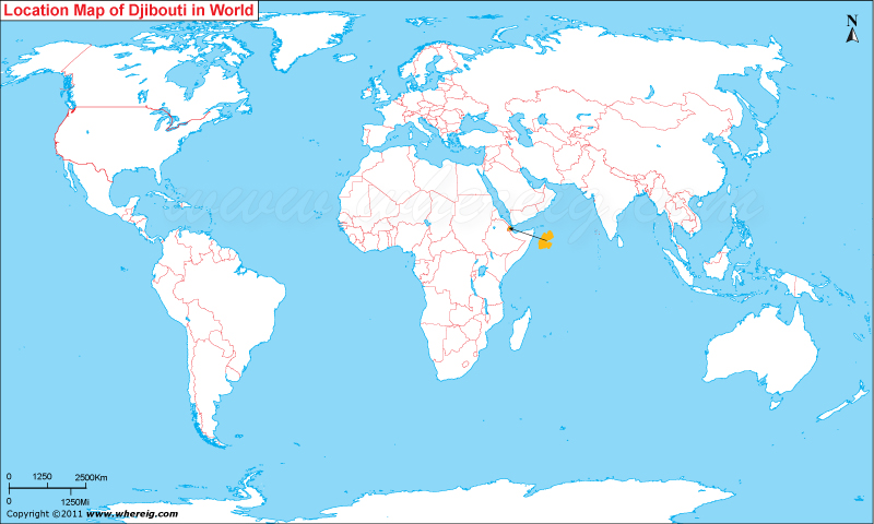
Where is Djibouti Located?
Djibouti is located in the eastern part of Africa at the coast of Red Sea.Official languages of Djibouti are Arabic and French and the main religion is Islam. The government type of Djibouti is a semi-presidential republic. The executive power is in the hand of central government and legislative power remains with both the government and parliament. Though two-third people of Djibouti live in the capital city Djibouti and the remaining live in other part of the country. The economy of the country largely depends upon the service activities pertaining to the country's strategic location.
| Country | Djibouti |
| Continent | Africa |
| Where is Located | Djibouti is a country located in the Eastern Africa |
| Coordinates | 11°36'N43°10'E |
| Capital | Djibouti City |
| Largest City | Djibouti City |
| Neighboring Countries | Eritrea, Ethiopia, Somalia |
| Administrative divisions | 6 districts |
| Area | 23,200 km2(8,958 sq mi) |
| Population | 792,198(2013 est.) |
| Official Language | French and Arabic |
| Currency | Franc |
| ISO Alpha-2 Code | DJ |
| ISO Alpha-3 Code | DJI |
| ISO Numeric Code | 262 |
| GDP | $2.379 billion(2012 est.) |
| Calling code | 253 |
| Time Zone | EAT (UTC+3) |
| Internet TLD | .dj |
- Where is Algeria
- Where is Angola
- Where is Benin
- Where is Botswana
- Where is Burkina Faso
- Where is Burundi
- Where is Cameroon
- Where is Canary Islands
- Where is Cape Verde
- Central African Republic
- Where is Ceuta
- Where is Chad
- Where is Cote d'Ivoire
- Where is Congo
- Where is Djibouti
- Where is Egypt
- Equatorial Guinea
- Where is Eritrea
- Where is Ethiopia
- Where is Gabon
- Where is Gambia
- Where is Ghana
- Where is Guinea
- Guinea Bissau
- Where is Kenya
- Where is Lesotho
- Where is Liberia
- Where is Libya
- Where is Madagascar
- Where is Madeira
- Where is Malawi
- Where is Mali
- Where is Mauritania
- Where is Mauritius
- Where is Mayotte
- Where is Morocco
- Where is Mozambique
- Where is Namibia
- Where is Niger
- Where is Nigeria
- Where is Congo
- Where is Reunion
- Where is Rwanda
- Where is Saint Helena
- Where is Sao Tome
- Where is Senegal
- Where is Seychelles
- Where is Sierra Leone
- Where is South Africa
- Where is Sudan
- Where is Swaziland
- Where is Tanzania
- Where is Togo
- Where is Tunisia
- Where is Uganda
- Where is Western Sahara
- Where is Zambia
- Where is Zimbabwe


