Where is Dominican Republic Located?
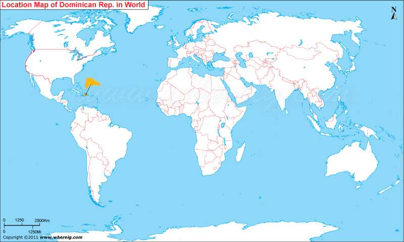
Where is Dominican Republic located on the world map? The given Dominican Republic location map shows that the Dominican Republic is located in the Caribbean Sea region.
Dominican Republic map also shows that the country is an island country but the island Hispaniola (where it is located) is divided into two part, in the eastern part – Dominican Republic lies whereas in the western part Haiti lies. The climate of the Dominican Republic is typically tropical type.
Interestingly, Santo Domingo which is capital city of the country has one of the oldest universities of North America continent including the university cathedral and the university castle. These two are also UNESCO World Heritage Site.
The government type of the Dominican Republic is a representative democracy or democratic republic under which there are three branches of power: executive, legislative, and judicial.
Furthermore, the country is second largest in terms of area in the Caribbean region after Cuba; besides, Dominican Republic has also second largest economy in the Caribbean and Central American region. By virtue of having year-round golf course and also having beautiful beaches and other tourists’ points, the Dominican Republic is the Caribbean's largest tourist destination.
| Country | Dominican Republic |
| Continent | North America |
| Where is Located | Dominican Republic is a country located in the Greater Antilles, Caribbean |
| Coordinates | 19°00'N70°40'W |
| Capital | Santo Domingo |
| Largest City | Santo Domingo |
| Neighboring Countries | Haiti |
| Administrative divisions | 31 provinces |
| Area | 48,442 km2 (130th) 18,704 sq mi |
| Population | 9445281 (2010 census) |
| Official Language | Spanish |
| Currency | Peso |
| ISO Alpha-2 Code | DO |
| ISO Alpha-3 Code | DOM |
| ISO Numeric Code | 214 |
| GDP | $98.7 billion 2012 estimate |
| Calling code | +1-809, +1-829, +1-849 |
| Time Zone | Atlantic (UTC-4) |
| Internet TLD | .do |
North America and Caribbean Countries Location Map
- Where is Antigua and Barbuda
- Where is Bahamas
- Where is Barbados
- Where is Belize
- Where is Canada
- Where is Costa Rica
- Where is Cuba
- Where is Dominica
- Where is Dominican Republic
- El Salvador
- Where is Guatemala
- Where is Greenland


