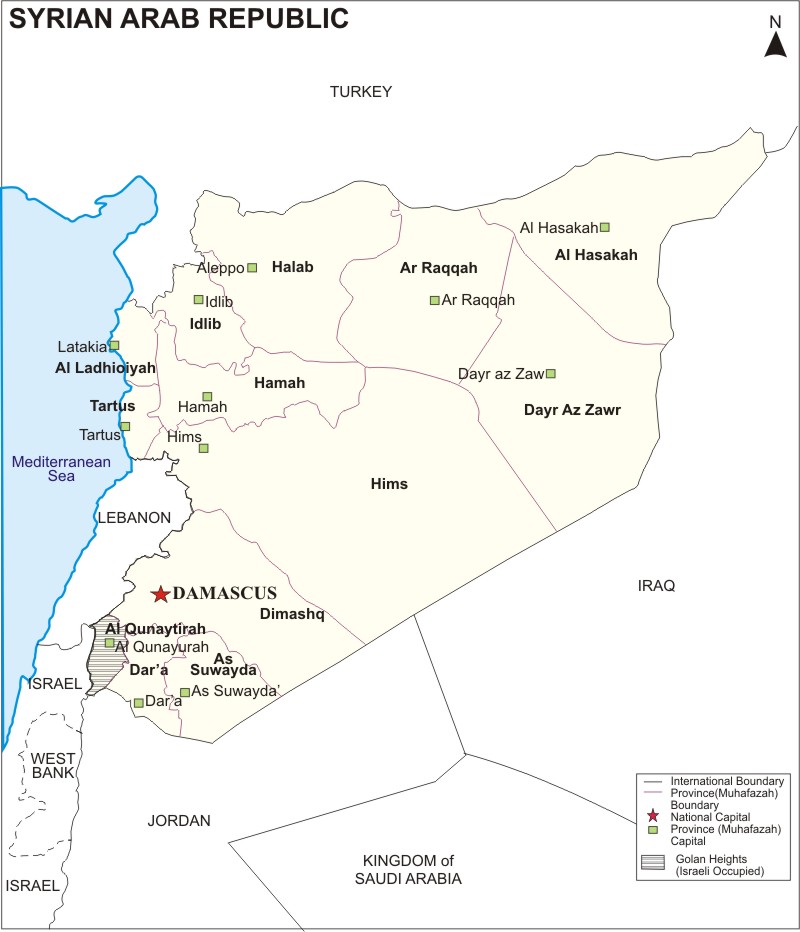
Map of Syria showing Syria provinces along with provinces boundary with capital, national and international boundary.
Syria is located in the Middle East, Western Asia bordering the Mediterranean Sea, between Lebanon and Turkey. Geographic coordinates: 35 00 N, 38 00 E.
Syria map also shows that it shares its international boundaries with Turkey in the north, Lebanon and Israel in the south-west, Jordan in the south, and Iraq in the west. Besides, country has also small coastline sharing with the Mediterranean Sea.
Syria Administrative divisions:
| Province | Population | Area(sq km.) | Area(sq mi.) |
|---|
| Aleppo | 4,045,166 | 18,498 | 7,142 |
| Al asakah | 1,275,118 | 23,334 | 9,009 |
| Ar Raqqah | 793,514 | 19,618 | 7,575 |
| As Suwayda' | 313,231 | 5,550 | 2,143 |
| Damascus | 1,552,161 | 118 | 46 |
| Dar'a | 843,478 | 3,730 | 1,440 |
| Dayr az Zawr | 1,004,747 | 33,060 | 12,765 |
| Hama | 1,384,953 | 10,163 | 3,924 |
| Himms | 1,529,402 | 40,940 | 15,807 |
| Idlib | 1,258,427 | 6,097 | 2,354 |
| Latakia | 879,551 | 2,297 | 887 |
| Quneitra | 66,593 | 1,861 | 719 |
| Rif Dimashq | 2,273,074 | 18,018 | 6,957 |
| Tartus | 701,395 | 1,896 | 732 |
| Official Name | Al Jumhuriyah al Arabiyah as Suriyah |
|---|
| Capital city | Damascus (Dimashq) |
| Official language | Arabic (official) |
| Government | Republic, under Arab Socialist Ba'ath Party regimes since March 1963. |
| Area | 185 170 sq. km. (71 504 sq. mi.) |
| Population | 17 million |
| Ethnic groups | Arabs (90%), Kurds (9%), Armenians, Circassians, Turkomans |
| Ethnic groups | Religions: Sunni Muslims (74%), Alawis (12%), Christians (10%), Druze (3%), and small numbers of other Muslim sects, Jews, and Yazidis |
| Currency | Syrian Pound (SYP) |
| Time zone | UTC +2h |
| ISO Code | sy |
| Calling code | 963 |


