Map of Bradford County - Bradford County is a county located in the U.S. state of Florida. Bradford County Map showing cities, highways, important places and water bodies. Get Where is Bradford County located in the map, major cities in Bradford county, population, areas, and places of interest.
Map of Bradford County, Florida
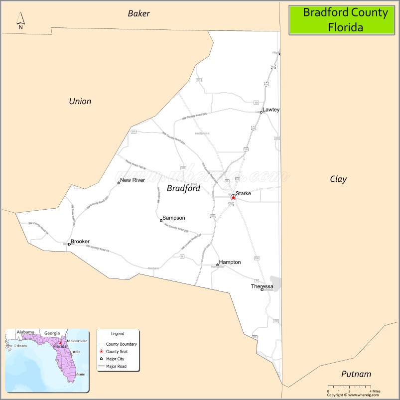
About Bradford County Map, Florida: The map showing the county boundary, county seat, major cities, highways, water bodies and neighbouring counties.
Most Viewed Links
About Bradford County, Florida
Bradford County is located in the north-central part of Florida, in the state of the United States. The county was established in 1858 and was named after Captain Richard Bradford, an officer in the American Revolutionary War. The county seat and largest city is Starke. Bradford County has a rural landscape and serves as a regional center for surrounding agricultural communities.
Population
According to the United States Census Bureau, the population of Bradford County is 28,303 as recorded in the 2020 Census, and the population density is approximately 96 people per square mile.
Area and Geography
According to the United States Census Bureau, Bradford County covers a total area of approximately 293 square miles (about 759 square kilometers), including about 288 square miles (746 square kilometers) of land and 5 square miles (13 square kilometers) of water. The county features gently rolling terrain, lakes, and forested areas typical of inland North Florida.
Bordering Counties
Bradford County shares boundaries with Clay County to the northeast, Putnam County to the southeast, Alachua County to the southwest, and Union County to the northwest.
Major Cities and Communities
Major cities and towns include Starke, Lawtey, Hampton, and Brooker.
Attractions and Recreation
Bradford County offers outdoor recreation centered around its lakes and parks, including Kingsley Lake, a popular destination for boating and fishing. Local festivals and community events in Starke reflect the county’s small-town heritage and agricultural roots.
Transportation
Bradford County is served by U.S. Highway 301, which runs north-south through Starke, and State Road 100, providing east-west connectivity. These routes connect the county to larger regional centers in Northeast Florida.
Explore more counties in Florida Counties or view the complete USA States Map section for additional geographic information.
Sources:
Population and area data sourced from the United States Census Bureau (2020 Census). General county information referenced from the Official Bradford County Government Website.
Facts about Bradford County, Florida
| Country | United States |
| State | Florida |
| Region | North Central Florida |
| County Seat | Starke |
| Named After | Captain Richard Bradford, War of 1812 officer |
| Established | 1858 |
| Organized | 1858 |
| Coordinates | 29.9500° N, 82.1700° W |
| Total Area | 301 sq mi |
| Land Area | 294 sq mi |
| Water Area | 7 sq mi |
| Population (2020) | 28,303 |
| Population Rank | Small county in North Central Florida |
| Major City | Starke |
| Main Industries | Corrections, Manufacturing, Agriculture, Retail |
| Major Airport | None (nearest major airports outside county) |
| Time Zone | Eastern Time (UTC−05:00) |
| Known For | Florida State Prison, Rural North Florida heritage, Proximity to Gainesville |
| Website | https://www.bradfordcountyfl.gov |