Map of Escambia County - Escambia County is a county located in the U.S. state of Florida. Escambia County Map showing cities, highways, important places and water bodies. Get Where is Escambia County located in the map, major cities in Escambia county, population, areas, and places of interest.
Map of Escambia County, Florida
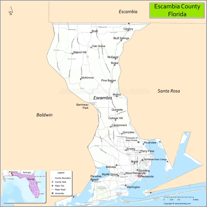
About Escambia County Map, Florida: The map showing the county boundary, county seat, major cities, highways, water bodies and neighbouring counties.
Most Viewed Links
About Escambia County, Florida
Escambia County is located in the northwestern part of Florida, in the state of the United States. The county was established in 1821 and was named after the Escambia River, which forms part of its northern boundary. The county seat and largest city is Pensacola. Escambia County is part of the Florida Panhandle and has a strong historical connection to early European settlement and maritime trade.
Population
According to the United States Census Bureau, the population of Escambia County was 321,905 as recorded in the 2020 Census.
Area and Geography
According to the United States Census Bureau, Escambia County covers a total area of approximately 875 square miles (about 2,266 square kilometers), including about 657 square miles (1,702 square kilometers) of land and 218 square miles (564 square kilometers) of water. The county features Gulf Coast beaches, bays, rivers, and forested inland areas, contributing to both tourism and outdoor recreation opportunities.
Bordering Counties
Escambia County shares boundaries with Alabama to the north, Santa Rosa County to the east, and the Gulf of Mexico to the south.
Major Cities and Communities
Major cities and towns include Pensacola, Century, Molino, Bellview, and Ensley.
Attractions and Recreation
Escambia County is known for its white-sand beaches along Pensacola Beach, historic downtown Pensacola, and cultural landmarks tied to its colonial heritage. Outdoor recreation includes boating, fishing, hiking, and wildlife observation in coastal and inland natural areas.
Transportation
Escambia County is served by Interstate 10, U.S. Highway 29, and U.S. Highway 98, providing regional connectivity across the Florida Panhandle. Pensacola International Airport supports commercial air service, while port facilities contribute to maritime commerce.
| Country | United States |
| State | Florida |
| Region | Western Florida Panhandle |
| County Seat | Pensacola |
| Named After | Escambia River |
| Established | 1821 |
| Organized | 1821 |
| Coordinates | 30.6111° N, 87.3417° W |
| Total Area | 875 sq mi |
| Land Area | 657 sq mi |
| Water Area | 218 sq mi |
| Population (2020) | 321,905 |
| Population Rank | One of the largest counties in the Florida Panhandle |
| Major City | Pensacola |
| Main Industries | Military, Healthcare, Tourism, Manufacturing |
| Major Airport | Pensacola International Airport |
| Time Zone | Central Time (UTC−06:00) |
| Known For | Naval Air Station Pensacola, Gulf Coast beaches, historic downtown |
| Website | https://www.escambiacountyfl.gov |