
Where is Beloit Located? - Beloit is a city located in the Rock County of Wisconsin, United States. Beloit lies between 43.6106237 Degrees North latitudes and 72.9726065 Degrees West longitudes.
Location Map of Beloit, Wisconsin
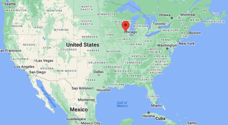
Beloit Map, Wisconsin, USA
Where is Beloit?: The Google Map showing the location of Beloit in the U.S. state of Wisconsin.
Where is Beloit Located?
Beloit is a city located in the Rock County of Wisconsin, United States. Beloit lies between 43.6106237 Degrees North latitudes and 72.9726065 Degrees West longitudes. According to 2020 U.S.census, the population of Beloit city is 36657 people and the city has a total area of 17.33 sq mi. The city has numerous parks and recreational facilities.
Most Viewed US Maps
| USA Sttae Map | USA Region Map | USA Road Map |
| USA County Map | Where is USA in World Map? | US ZIP Code Map |
| USA Time Zones Map | US State and Capitals Map | USA Physical Map |
Find 4,400+ U.S. Cities by State - Explore Their Locations and Get Detailed Information
Beloit, Wisconsin Quick Facts
| Fact | Details |
|---|---|
| City | Beloit |
| County | Rock County |
| State | Wisconsin |
| State Capital | Madison |
| Country | United States |
| US Region | Midwest |
| Latitude | 42.5083°N |
| Longitude | 89.0318°W |
| Elevation | 768 ft (234 m) |
| Land Area | 17.70 sq mi |
| Water Area | 0.37 sq mi |
| Total Area | 18.07 sq mi |
| Population (Census 2020) | 36,657 |
| Population Density | Approximately 2,071 per sq mi |
| ZIP Codes | 53511, 53512 |
| Area Code | 608 |
| Time Zone Standard | Central Standard Time (CST, UTC-6) |
| Time Zone Daylight | Central Daylight Time (CDT, UTC-5) |
| Currency | United States Dollar (USD) |
| FIPS Code | 55-06250 |
| Congressional District | Wisconsin's 1st Congressional District |
Nearby Cities to Beloit, Wisconsin
- South Beloit, Illinois - 2 mi South
- Roscoe, Illinois - 7 mi South
- Janesville, Wisconsin - 14 mi North
- Rockton, Illinois - 8 mi South
- Clinton, Wisconsin - 12 mi West
- Loves Park, Illinois - 15 mi South
- Rockford, Illinois - 18 mi South
- Evansville, Wisconsin - 21 mi North
- Delavan, Wisconsin - 27 mi East
- Madison, Wisconsin - 52 mi Northwest
Beloit, Wisconsin Climate and Weather Overview
| Month | Avg High (°F) | Avg Low (°F) | Avg Rainfall (in) |
|---|---|---|---|
| January | 29 | 13 | 1.5 |
| April | 59 | 39 | 3.8 |
| July | 83 | 63 | 4.3 |
| October | 61 | 42 | 2.8 |
| Annual | 58 | 39 | 37.0 |
| Climate Attribute | Details |
|---|---|
| Climate Classification | Hot-Summer Humid Continental (Köppen Dfa) |
| Annual Rainfall | Approximately 37 inches |
| Annual Sunshine Days | About 188 days |
| Hurricane/Tornado Risk | Moderate - Thunderstorms, tornadoes and winter storms |
| Snowfall | Approximately 35 inches annually |
Driving Distances from Beloit, Wisconsin
| City | State | Distance (mi) | Approx. Drive Time |
|---|---|---|---|
| South Beloit | Illinois | 2 | 5 min |
| Roscoe | Illinois | 7 | 10 min |
| Rockton | Illinois | 8 | 12 min |
| Clinton | Wisconsin | 12 | 15 min |
| Janesville | Wisconsin | 14 | 18 min |
| Loves Park | Illinois | 15 | 20 min |
| Rockford | Illinois | 18 | 25 min |
| Evansville | Wisconsin | 21 | 28 min |
| Delavan | Wisconsin | 27 | 35 min |
| Madison | Wisconsin | 52 | 1 hr |
Transportation and Connectivity in Beloit, Wisconsin
| Transportation | Details |
|---|---|
| Airport Name | Southern Wisconsin Regional Airport |
| IATA Code | JVL |
| Port | Not Applicable |
| Major Highways | Interstate 39, Interstate 90, Interstate 43, U.S. Highway 51 |
| Train/Amtrak Service | No passenger rail service; nearest Amtrak station in Glenview, Illinois |
| Local Bus/Transit Service | Beloit Transit System (BTS) |
- Interstate 39 - Major north-south route connecting Beloit with Madison, Rockford and central Illinois.
- Interstate 90 - Primary east-west interstate providing access to Madison, Chicago and the Upper Midwest.
- Interstate 43 - Begins in Beloit and connects the city with Milwaukee and eastern Wisconsin.
- U.S. Highway 51 - Regional highway linking Beloit with Janesville and communities throughout southern Wisconsin.
Key Landmarks and Places to Visit in Beloit, Wisconsin
| Landmark | Type |
|---|---|
| Riverside Park | Riverfront Park |
| Beloit College | Historic College Campus |
| Logan Museum of Anthropology | Museum |
| Angel Museum | Specialty Museum |
| Beloit Farmers' Market | Market |
| Downtown Beloit Historic District | Historic District |
| Telfer Park | Community Park |
| Big Hill Park | Nature Park |
| Harry C. Moore Pavilion | Event Venue |
| Beckman Mill County Park | Historic Park |
Colleges and Universities in Beloit, Wisconsin
| Institution | Type | Level | Notable For |
|---|---|---|---|
| Beloit College | Private | College | Liberal arts and anthropology |
| Blackhawk Technical College | Public | Technical College | Career and workforce education |
| University of Wisconsin-Whitewater at Rock County | Public | University Center | Associate and bachelor's programs |
| Rock Valley College | Public | Community College | Transfer and technical education |
| University of Wisconsin-Whitewater | Public | University | Business and education |
| Northern Illinois University | Public | University | Research and engineering |
Waterbodies in Beloit, Wisconsin
Rock River, Turtle Creek, Turtle Creek Floodplain, Beckman Mill Pond, Big Hill Creek, Sugar River, Lake Koshkonong, Lake Summerset, Pierce Lake, Lake Geneva.
Golf Courses in Beloit, Wisconsin
Krueger-Haskell Golf Course, Beloit Club, The Oaks Golf Course, Macktown Golf Course, Prairie View Golf Course, Aldeen Golf Club, Ingersoll Golf Course, Geneva National Golf Club.
Beloit, Wisconsin - Key Historical Facts
- Beloit was founded in 1836 along the Rock River and quickly developed as a milling and manufacturing center.
- The arrival of the railroad in the nineteenth century helped establish the city as an important transportation and industrial hub in southern Wisconsin.
- Beloit College, founded in 1846, is Wisconsin's oldest continuously operating college and has played a major role in the city's educational and cultural development.
- Manufacturing industries, including machinery, engines and foundries, shaped the local economy throughout much of the twentieth century.
- Downtown Beloit has undergone extensive revitalization, preserving historic buildings while adding restaurants, shops and public spaces.
- Today, Beloit is known for its manufacturing heritage, vibrant riverfront, higher education, thriving arts scene and strategic location on the Wisconsin-Illinois border.
References
Wisconsin Maps and Info
- Where is Appleton
- Where is Ashwaubenon
- Where is Beloit
- Where is Brookfield
- Where is Caledonia
- Where is Cudahy
- Where is De Pere
- Where is Eau Claire
- Where is Fitchburg
- Where is Fond du Lac
- Where is Franklin
- Where is Germantown
- Where is Green Bay
- Where is Greenfield
- Where is Howard
- Where is Janesville
- Where is Kaukauna
- Where is Kenosha
- Where is La Crosse
- Where is Manitowoc
- Where is Marshfield
- Where is Menasha
- Where is Menomonee Falls
- Where is Menomonie
- Where is Mequon
- Where is Middleton
- Where is Mount Pleasant
- Where is Muskego
- Where is Neenah
- Where is New Berlin
- Where is Oak Creek
- Where is Oconomowoc
- Where is Onalaska
- Where is Oshkosh
- Where is Pleasant Prairie
- Where is Racine
- Where is Sheboygan
- Where is South Milwaukee
- Where is Stevens Point
- Where is Sun Prairie
- Where is Superior
- Where is Watertown
- Where is Waukesha
- Where is Wausau
- Where is Wauwatosa
- Where is West Allis
- Where is West Bend
- Where is Wisconsin Rapids