
Where is Brookfield Located? - Brookfield is a city located in the Waukesha County of Wisconsin, United States. Brookfield lies between 43.06217 Degrees North latitudes and -88.098 Degrees West longitudes.
Location Map of Brookfield, Wisconsin
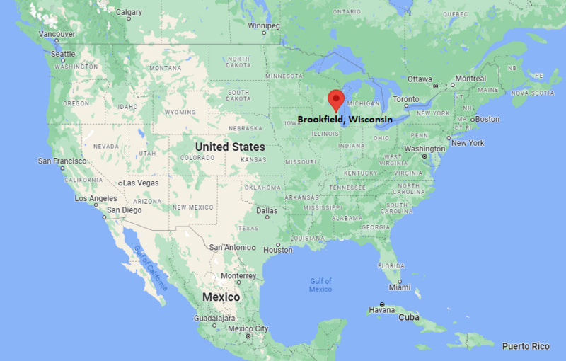
Brookfield Map, Wisconsin, USA
Where is Brookfield?: The Google Map showing the location of Brookfield in the U.S. state of Wisconsin.
Where is Brookfield Located?
Brookfield is a city located in the Waukesha County of Wisconsin, United States. Brookfield lies between 43.06217 Degrees North latitude and -88.098 Degrees West longitude. According to the 2020 U.S. Census, the population of Brookfield city is 41,464 people and the city has a total area of 27.657 sq mi. The city has numerous parks and recreational facilities.
Most Viewed US Maps
| USA Sttae Map | USA Region Map | USA Road Map |
| USA County Map | Where is USA in World Map? | US ZIP Code Map |
| USA Time Zones Map | US State and Capitals Map | USA Physical Map |
Find 4,400+ U.S. Cities by State - Explore Their Locations and Get Detailed Information
Brookfield, Wisconsin Quick Facts
| Fact | Details |
|---|---|
| City | Brookfield |
| County | Waukesha County |
| State | Wisconsin |
| State Capital | Madison |
| Country | United States |
| US Region | Midwest |
| Latitude | 43.06217 N |
| Longitude | -88.098 W |
| Elevation | 846 ft (258 m) |
| Land Area | approx. 27.3 sq mi |
| Water Area | approx. 0.2 sq mi |
| Total Area | approx. 27.657 sq mi |
| Population (Census 2020) | 41,464 |
| Population Density | Approximately 1,520 per sq mi |
| ZIP Codes | 53005, 53045, 53008 |
| Area Code | 262 |
| Time Zone Standard | Central Standard Time (CST, UTC-6) |
| Time Zone Daylight | Central Daylight Time (CDT, UTC-5) |
| Currency | United States Dollar (USD) |
| FIPS Code | 55-10000 |
| Congressional District | Wisconsin's 5th Congressional District |
Nearby Cities and Towns to Brookfield, Wisconsin
- Waukesha, Wisconsin - 6 mi West
- Milwaukee, Wisconsin - 11 mi East
- Elm Grove, Wisconsin - 2 mi East
- Pewaukee, Wisconsin - 7 mi Northwest
- New Berlin, Wisconsin - 6 mi South
- Menomonee Falls, Wisconsin - 10 mi North
- West Allis, Wisconsin - 8 mi East
- Brookfield (Town area neighborhoods) - Within city limits
- Delafield, Wisconsin - 15 mi West
- Germantown, Wisconsin - 16 mi North
Brookfield, Wisconsin Climate and Weather Overview
| Month | Avg High (°F) | Avg Low (°F) | Avg Precipitation (in) |
|---|---|---|---|
| January | 28 | 12 | 1.5 |
| April | 55 | 35 | 3.2 |
| July | 82 | 63 | 3.8 |
| October | 58 | 41 | 2.8 |
| Annual | 56 | 38 | 34.5 |
| Climate Attribute | Details |
|---|---|
| Climate Classification | Humid Continental (Köppen Dfb) |
| Annual Precipitation | Approximately 34.5 inches |
| Annual Snowfall | About 45–55 inches |
| Severe Weather Risk | Moderate - thunderstorms, snowstorms, occasional tornado risk |
| Annual Sunshine Days | About 190 days |
Driving Distances from Brookfield, Wisconsin
| City | State | Distance (mi) | Approx. Drive Time |
|---|---|---|---|
| Milwaukee | Wisconsin | 11 | 20 min |
| Waukesha | Wisconsin | 6 | 12 min |
| New Berlin | Wisconsin | 6 | 10 min |
| Pewaukee | Wisconsin | 7 | 12 min |
| West Allis | Wisconsin | 8 | 15 min |
| Menomonee Falls | Wisconsin | 10 | 18 min |
| Oconomowoc | Wisconsin | 20 | 25 min |
| Delafield | Wisconsin | 15 | 20 min |
| Madison | Wisconsin | 75 | 1 hr 15 min |
| Chicago | Illinois | 95 | 1 hr 40 min |
Transportation and Connectivity in Brookfield, Wisconsin
| Transportation | Details |
|---|---|
| Nearest Airport | General Mitchell International Airport |
| IATA Code | MKE |
| Nearest Major Airport | O'Hare International Airport (Chicago) |
| Major Highways | I-94, I-41, U.S. Route 18, Bluemound Road (WI-18) |
| Rail Service | Amtrak (Milwaukee Intermodal Station nearby) |
| Local Transit | Waukesha Metro Transit / Milwaukee County Transit System |
- I-94 connects Brookfield directly to Milwaukee and Madison.
- U.S. Route 18 runs through the city as Bluemound Road, a major commercial corridor.
- General Mitchell International Airport (MKE) is the closest major airport.
- Milwaukee Intermodal Station provides Amtrak rail connections across the Midwest.
Key Landmarks and Places to Visit in Brookfield, Wisconsin
| Landmark | Type |
|---|---|
| Fox Brook Park | County Park |
| Mitchell Park | Community Park |
| Brookfield Square Mall | Shopping Mall |
| Wirth Park | Recreation Park |
| Sharon Lynne Wilson Center for the Arts | Arts Center |
| Fox Brook Lake | Recreation Lake |
| Greenway Trail System | Trail Network |
| Emery Park | Neighborhood Park |
| Brookfield Conference Center | Event Venue |
| Moorland Road Commercial District | Shopping & Dining Area |
Colleges and Universities in Brookfield, Wisconsin
| Institution | Type | Level | Notable For |
|---|---|---|---|
| University of Wisconsin–Milwaukee | Public | Research University | Engineering, business, health sciences |
| University of Wisconsin–Madison | Public | Research University | Top-ranked research, medicine, law, agriculture |
| Waukesha County Technical College | Public | Technical College | Career training, applied sciences, trades |
| Marquette University | Private | University | Law, business, health sciences |
| Concordia University Wisconsin | Private | University | Nursing, business, education |
| Milwaukee Area Technical College | Public | Technical College | Associate degrees and workforce programs |
Waterbodies in Brookfield, Wisconsin
Fox Brook Lake, Elm Brook, Underwood Creek, Menomonee River, Pewaukee Lake (nearby), Muskego Lake (regional), Lake Michigan (regional), Nashotah Lake (nearby), Okauchee Lake (regional), Spring Creek.
Golf Courses in Brookfield, Wisconsin
Brookfield Hills Golf Course, Currie Park Golf Course (nearby Milwaukee), Noyes Park Golf Course, Bluemound Country Club, Brookfield Country Club, Western Lakes Golf Club, The Legend at Bristlecone, Washington County Golf Course (regional).
Brookfield, Wisconsin - Key Historical Facts
- Brookfield was originally inhabited by Native American tribes, including the Potawatomi.
- European settlement began in the 1830s as farming communities developed in the area.
- The town of Brookfield was officially established in the mid-19th century.
- Post-World War II suburban expansion transformed Brookfield into a major residential suburb of Milwaukee.
- The development of I-94 and surrounding highways boosted commercial and residential growth.
- Today, Brookfield is known for its suburban neighborhoods, business centers, parks, and high quality of life.
References
Wisconsin Maps and Info
- Where is Appleton
- Where is Ashwaubenon
- Where is Beloit
- Where is Brookfield
- Where is Caledonia
- Where is Cudahy
- Where is De Pere
- Where is Eau Claire
- Where is Fitchburg
- Where is Fond du Lac
- Where is Franklin
- Where is Germantown
- Where is Green Bay
- Where is Greenfield
- Where is Howard
- Where is Janesville
- Where is Kaukauna
- Where is Kenosha
- Where is La Crosse
- Where is Manitowoc
- Where is Marshfield
- Where is Menasha
- Where is Menomonee Falls
- Where is Menomonie
- Where is Mequon
- Where is Middleton
- Where is Mount Pleasant
- Where is Muskego
- Where is Neenah
- Where is New Berlin
- Where is Oak Creek
- Where is Oconomowoc
- Where is Onalaska
- Where is Oshkosh
- Where is Pleasant Prairie
- Where is Racine
- Where is Sheboygan
- Where is South Milwaukee
- Where is Stevens Point
- Where is Sun Prairie
- Where is Superior
- Where is Watertown
- Where is Waukesha
- Where is Wausau
- Where is Wauwatosa
- Where is West Allis
- Where is West Bend
- Where is Wisconsin Rapids