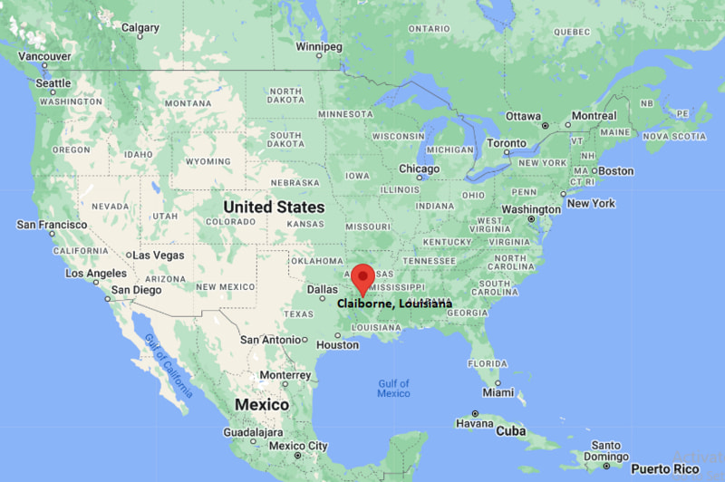
Where is Claiborne Located? - Claiborne is a city located in the Ouachita Parish County of Louisiana, United States. Claiborne lies between 42.2917069 Degrees North latitudes and 85.5872286 Degrees West longitudes.
Location Map of Claiborne, Louisiana
Claiborne Map, Louisiana, USA
Where is Claiborne?: The Google Map showing the location of Claiborne in the U.S. state of Louisiana.
Where is Claiborne Located?
Claiborne is a city located in the Ouachita Parish County of Louisiana, United States. Claiborne lies between 42.2917069 Degrees North latitudes and 85.5872286 Degrees West longitudes. According to 2020 U.S.census, the population of Claiborne city is 12631 people and the city has a total area of 9.96 sq mi. The city has numerous parks and recreational facilities.
Freight rail service in the Monroe-West Monroe area
Local Bus/Transit Service
Monroe Transit System (nearby)
Interstate 20 provides convenient highway access to Monroe, Ruston, Shreveport, and Vicksburg.
Monroe Regional Airport, about 12 miles southeast, offers scheduled commercial flights and general aviation services.
Monroe Transit System provides public transportation throughout nearby Monroe and West Monroe.
U.S. Route 80 and local state highways connect Claiborne with surrounding communities across Ouachita Parish.
Claiborne is a residential community within the Monroe metropolitan area, offering easy access to shopping, healthcare, schools, and outdoor recreation.
Key Landmarks and Places to Visit in Claiborne, Louisiana
Landmark Name
Type
Black Bayou Lake National Wildlife Refuge
Wildlife Refuge
Kiroli Park
Nature Park
Biedenharn Museum & Gardens
History Museum
Louisiana Purchase Gardens and Zoo
Zoo
Chennault Aviation and Military Museum
Aviation Museum
Forsythe Park
City Park
Restoration Park
Community Park
Ike Hamilton Expo Center
Events and Exhibition Center
Duck Commander Museum
Specialty Museum
Ouachita River Levee Trail
Walking and Cycling Trail
Colleges and Universities in and near Claiborne, Louisiana
Institution Name
Type
Level
Notable For
University of Louisiana Monroe
Public
University
Pharmacy, nursing, business, education, and research
Louisiana Delta Community College
Public
Community College
Workforce training, healthcare, technical education, and transfer programs
Louisiana Tech University
Public
University
Engineering, business, aviation, and applied sciences
Grambling State University
Public
University
Liberal arts, education, business, and athletics
Northeast Louisiana Technical Community College
Public
Technical College
Career and technical education, manufacturing, and skilled trades
Waterbodies in Claiborne, Louisiana
Ouachita River, Black Bayou Lake, Bayou DeSiard, Bayou Lafourche, Cheniere Lake, Wallace Lake, Flat Creek, Bayou Bartholomew
Golf Courses in and near Claiborne, Louisiana
Frenchman's Bend Golf Course, Chennault Park Golf Course, Calvert Crossing Golf Club, Black Bear Golf Club, Southern Pines Golf Club, Crooked Hollow Golf Club, Pine Hills Country Club, Links at Muny
Claiborne, Louisiana - Key Historical Facts
Claiborne developed as a small rural community in Ouachita Parish during the late nineteenth and early twentieth centuries.
Its growth was closely tied to agriculture, timber production, and the commercial expansion of nearby Monroe and West Monroe.
Improved highways and transportation links encouraged residential development as the Monroe metropolitan area expanded.
The community has benefited from its proximity to major educational institutions, healthcare facilities, and regional employers.
Outdoor recreation along the Ouachita River and nearby wildlife refuges has become an important part of the area's lifestyle.
Today, Claiborne is recognized as a suburban residential community offering convenient access to Monroe while maintaining a quieter small-community setting.