
Marksville is a city in central Louisiana and the parish seat of Avoyelles Parish. Located about 60 miles southeast of Alexandria, it sits in the state's historic Cane River and Red River region. Marksville is known for its ancient Native American earthworks, Tunica-Biloxi Cultural and Educational Resources Center, historic downtown, and nearby Lake Ophelia National Wildlife Refuge.
Location Map of Marksville, Avoyelles Parish, Louisiana
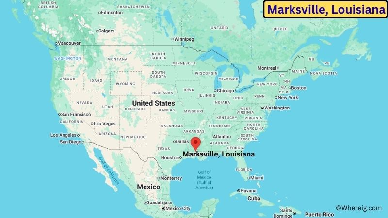
About Map: The map shows the location of Marksville in Avoyelles Parish, in the U.S. state of Louisiana.
Marksville Map, Louisiana
About Marksville Map: The Google Map highlights the location of Marksville in Avoyelles Parish, Louisiana. Use the zoom, satellite, and street-view options to explore the city's neighborhoods, roads, and nearby places.
Where is Marksville Located?
Marksville is a city located in Avoyelles Parish, Louisiana, the United States. It lies in central Louisiana, about 60 miles southeast of Alexandria and roughly 70 miles north of Baton Rouge. Marksville is located at approximately 31.128° North latitude and 92.063° West longitude. The 2020 Census recorded 4,537 residents, and the city covers about 5.28 square miles (13.68 sq km). Marksville was founded in the late 18th century and incorporated in 1809, making it one of the older communities in central Louisiana. The city serves as the parish seat of Avoyelles Parish and developed as a regional center for agriculture, trade, and government. The surrounding landscape includes bayous, wetlands, farmland, and wooded areas associated with the Red River basin. Marksville State Historic Site is one of the area's most important attractions and preserves ancient Native American ceremonial earthworks built by the ancestors of the region's Indigenous peoples. The site includes large mounds, a museum, and interpretive information about the prehistoric settlement. The Tunica-Biloxi Tribe has also played an important role in preserving the area's Native American heritage. A unique feature of Marksville is the combination of ancient archaeological sites and the long history of the modern community. Lake Ophelia National Wildlife Refuge lies nearby and protects wetlands, forests, and habitat for migratory birds and other wildlife. U.S. Highway 71 and Louisiana Highway 1 provide major road connections to Alexandria, Bunkie, Cottonport, and other central Louisiana communities.
Most Viewed US Maps
| USA Sttae Map | USA Region Map | USA Road Map |
| USA County Map | Where is USA in World Map? | US ZIP Code Map |
| USA Time Zones Map | US State and Capitals Map | USA Physical Map |
Find 4,400+ U.S. Cities by State - Explore Their Locations and Get Detailed Information
Marksville City Facts
| City | Marksville |
| State | Louisiana |
| County | Avoyelles Parish |
| Country | United States |
| Region | Central Louisiana |
| Incorporated | 1809 |
| Founded | 18th century |
| Total Area | 5.28 sq mi (13.68 sq km) |
| Land Area | 5.27 sq mi (13.65 sq km) |
| Water Area | 0.01 sq mi (0.03 sq km) |
| Elevation | About 75 ft (23 m) |
| Population (2023 estimate) | About 4,500 |
| Population (2020 Census) | 4,537 |
| Population Density | About 861 people per sq mi |
| Time Zone | Central Time (CT) |
| ZIP Codes | 71351 |
| Area Code | 318 |
| Major Highways | U.S. Highway 71, Louisiana Highway 1, Louisiana Highway 107 |
| Public Transit | Avoyelles Parish transportation services |
| Major Attractions | Marksville State Historic Site, Tunica-Biloxi Museum, Lake Ophelia National Wildlife Refuge, Paragon Casino Resort |
| Official Website | https://www.cityofmarksville.com/ |
Distance from Marksville, LA to Nearby Cities
- Moreauville, LA – 10 miles (16 km)
- Cottonport, LA – 15 miles (24 km)
- Bunkie, LA – 20 miles (32 km)
- Simmesport, LA – 20 miles (32 km)
- Alexandria, LA – 60 miles (97 km)
- Ville Platte, LA – 40 miles (64 km)
- Opelousas, LA – 45 miles (72 km)
- Oakdale, LA – 55 miles (89 km)
- Ferriday, LA – 65 miles (105 km)
- Natchitoches, LA – 80 miles (129 km)
- Natchez, MS – 75 miles (121 km)
- Baton Rouge, LA – 75 miles (121 km)
- Lafayette, LA – 90 miles (145 km)
- Monroe, LA – 100 miles (161 km)
- Lake Charles, LA – 120 miles (193 km)
Top Attractions in Marksville
- Marksville State Historic Site – An important archaeological site preserving ancient Native American ceremonial earthworks and mounds.
- Tunica-Biloxi Cultural and Educational Resources Center – A cultural center preserving and interpreting the history and heritage of the Tunica-Biloxi people.
- Lake Ophelia National Wildlife Refuge – A protected area of wetlands, forests, lakes, and wildlife habitat near Marksville.
- Paragon Casino Resort – A regional entertainment and gaming destination operated by the Tunica-Biloxi Tribe.
- Avoyelles Parish Courthouse – A historic civic landmark in downtown Marksville serving as the center of parish government.
- Spring Bayou Wildlife Management Area – A nearby wetland landscape with waterways, forests, fishing opportunities, and wildlife habitat.
- Red River – A major regional river system shaping the landscape and natural environment around central Louisiana.
- Alexandria Zoological Park – A nearby zoo in Alexandria featuring animals from around the world, educational programs, and family exhibits.
Airports Near Marksville
- Alexandria International Airport (AEX) – 45 miles
- Esler Regional Airport (ESF) – 50 miles
- Marksville Municipal Airport (MKV) – 5 miles
- Baton Rouge Metropolitan Airport (BTR) – 90 miles
- Lafayette Regional Airport (LFT) – 100 miles
Sources:
Population and area data sourced from the United States Census Bureau (2020 Census). General city information referenced from the official Marksville city website and local government records.
Louisiana Related Maps and Info
- Where is Alexandria
- Where is Baker
- Where is Bayou Blue
- Where is Bayou Cane
- Where is Bossier City
- Where is Broussard
- Where is Central
- Where is Chalmette
- Where is Claiborne
- Where is Covington
- Where is Crowley
- Where is Destrehan
- Where is Estelle
- Where is Gardere
- Where is Gonzales
- Where is Gretna
- Where is Hammond
- Where is Harvey
- Where is Houma
- Where is Kenner
- Where is Lafayette
- Where is Lake Charles
- Where is Laplace
- Where is Luling
- Where is Mandeville
- Where is Marrero
- Where is Metairie
- Where is Minden
- Where is Monroe
- Where is Morgan City
- Where is Moss Bluff
- Where is Natchitoches
- Where is New Iberia
- Where is Opelousas
- Where is Pineville
- Where is Prairieville
- Where is River Ridge
- Where is Ruston
- Where is Shenandoah
- Where is Slidell
- Where is Sulphur
- Where is Terrytown
- Where is Thibodaux
- Where is West Monroe
- Where is Woodmere
- Where is Youngsville
- Where is Zachary