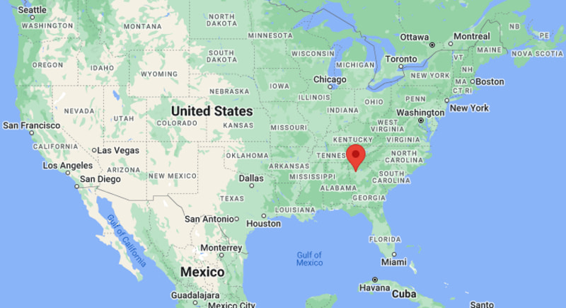
Where is Acworth Located? - Acworth is a city located in the Cobb County of Georgia, United States. Acworth lies between 34.0738 Degrees North latitudes and 84.6772 Degrees West longitudes.
Location Map of Acworth, Georgia
Acworth Map, Georgia, USA
Where is Acworth?: The Google Map showing the location of Acworth in the U.S. state of Georgia.
Where is Acworth Located?
Acworth is a city located in Cobb County of Georgia, United States. Acworth lies at approximately 34.0738 Degrees North latitude and 84.6772 Degrees West longitude. According to the 2020 U.S. Census, the population of Acworth city was 22,440 people, and the city has a total area of 8.8 sq mi. The city has numerous parks and recreational facilities.
Transportation and Connectivity in Acworth, Georgia
Nearest Airport
Hartsfield-Jackson Atlanta International Airport
IATA Code
ATL
Major Highways
Interstate 75, Georgia State Route 92, US Highway 41
Rail Service
Regional Freight Rail Service
Public Transit
CobbLinc Regional Transit
Interstate 75 provides direct access to Atlanta and Chattanooga.
US Highway 41 serves as a major local transportation corridor.
Georgia State Route 92 connects Acworth with Cherokee and Paulding counties.
Hartsfield-Jackson Atlanta International Airport is approximately 45 miles away.
CobbLinc transit services connect the city with surrounding metro Atlanta communities.
Key Landmarks and Places to Visit in Acworth, Georgia
Landmark Name
Type
Lake Acworth
Lake and Recreation Area
Cauble Park
City Park
Lake Allatoona
Reservoir
Red Top Mountain State Park
State Park
Historic Downtown Acworth
Historic District
Logan Farm Park
Community Park
Cobb County Veterans Memorial
Memorial
Dallas Landing Park
Waterfront Park
Acworth Beach
Recreation Area
Southern Museum of Civil War and Locomotive History
Museum
Colleges and Universities Near Acworth, Georgia
Institution Name
Type
Distance
Notable For
Kennesaw State University
Public University
8 mi
Research and technology programs
Chattahoochee Technical College
Technical College
7 mi
Career and workforce training
Life University
Private University
16 mi
Health sciences and chiropractic education
Georgia Highlands College
Public College
18 mi
Associate and bachelor's programs
Georgia Institute of Technology
Public University
33 mi
Engineering and research
Waterbodies in and Near Acworth, Georgia
Lake Acworth, Lake Allatoona, Allatoona Creek, Proctor Creek, Etowah River, Little River, Kellogg Creek, Acworth Beach Lagoon, Dallas Landing Cove, Allatoona Reservoir Shoreline
Golf Courses in and Near Acworth, Georgia
Cobblestone Golf Course, Brookstone Golf and Country Club, Bentwater Golf Club, Pinetree Country Club, Towne Lake Hills Golf Club, Eagle Watch Golf Club, Governors Towne Club, Dogwood Golf Club
Acworth, Georgia - Key Historical Facts
Acworth was incorporated in 1860 and developed as a railroad town along the Western and Atlantic Railroad.
The city grew as an agricultural and transportation center in northwestern Georgia.
Construction of Lake Allatoona in the 1940s transformed the area into a popular recreation destination.
Historic Downtown Acworth preserves many nineteenth and early twentieth-century buildings.
The city's lakes and parks have helped make tourism and outdoor recreation important parts of the local economy.
Today, Acworth is one of the fastest-growing communities in the Atlanta metropolitan area.